/reports/forecaster-notes/south-east-queensland-northern-new-south-wales/2021/11/29/grovel-worthy
freeride76
Monday, 29 November 2021

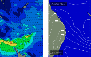
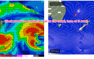
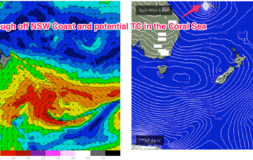
A broad but weak tradewind fetch pushes south from the Coral Sea, extending out towards New Caledonia, and looping around a long trough extending from roughly Lord Howe up into the tropics.

/reports/forecaster-notes/south-east-queensland-northern-new-south-wales/2021/11/26/rain-wind-and
freeride76
Friday, 26 November 2021

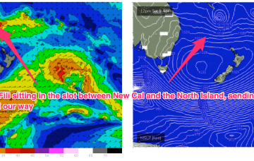
The weak troughy pattern in the Tasman Sea is connected up with several, broad, diffuse and disconnected E’ly windfields in the region near New Caledonia and extending out into the South Pacific. Taken individually these fetches aren’t worth much, but as a collective we’ll be looking at another episode of pulsey background E swell with up and down periods and size in the 2-3ft range.

/reports/forecaster-notes/south-east-queensland-northern-new-south-wales/2021/11/24/winds-tending-ne
freeride76
Wednesday, 24 November 2021

Lots of S quarter swell and wind from the same direction this weekend. With the trough extending out from the NSW South Coast towards the South Island, and a long fetch of S/SSE gales developing through the lower Tasman, there’ll be no shortage of size. 

/reports/forecaster-notes/south-east-queensland-northern-new-south-wales/2021/11/22/workable-ely
freeride76
Monday, 22 November 2021

Further north from Yamba up into SEQLD, swell will be mostly generated by a broad coverage of ESE winds in the Southern Coral Sea and Northern Tasman.

/reports/forecaster-notes/south-east-queensland-northern-new-south-wales/2021/11/19/lots-onshore-wind
freeride76
Friday, 19 November 2021

Dominant high pressure sits just East of Tasmania by Mon next week, directing a strong E’ly flow, likely enhanced by the remnants of the interior low sitting off the Central/Mid-North NSW Coast.

/reports/forecaster-notes/south-east-queensland-northern-new-south-wales/2021/11/17/uninspiring
freeride76
Wednesday, 17 November 2021

Weak fronts are below the country and an inland low is tracking across from WA, tied to the continuing pattern of interior troughiness which is associated with a developing La Nina pattern. This pattern, which has been with us for most of the last few weeks, is expected to see continuing small, flukey swells into the medium term.

/reports/forecaster-notes/south-east-queensland-northern-new-south-wales/2021/11/15/moderate-strength
freeride76
Monday, 15 November 2021

A deep mid-latitude low with high pressure support in the Bight and multiple cold fronts has now moved E of Tasmania with W to SW gales pushing out of Bass Strait and a deeper SSW fetch pushing up from the Southern Ocean into the Tasman Sea. It’s a wintry looking system and it has a nice sting in the tail as a small troughy intensification slingshots up into the Tasman Sea through tomorrow, giving another longer period pulse S swell to add onto the main body of the swell.

/reports/forecaster-notes/south-east-queensland-northern-new-south-wales/2021/11/12/small-the-s
freeride76
Friday, 12 November 2021

Winds will be from the Western quadrant all weekend and the surf is likely to be ironed flat in SEQLD, with the small S swell trains on offer not likely to make landfall north of the border, save a few small peaks at the mouth of the Tweed.

/reports/forecaster-notes/south-east-queensland-northern-new-south-wales/2021/11/10/lots-wind-changes
freeride76
Wednesday, 10 November 2021

No great pressure gradient squeezes are on offer at present with only flabby high pressure drifting NE in the Tasman sea. Weak swells and wind changes continue.

/reports/forecaster-notes/south-east-queensland-northern-new-south-wales/2021/11/08/bland-week-ahead
freeride76
Monday, 8 November 2021

Pressure gradients are weak across our main swell windows and through the region as an interior trough drifts NE and a weak, troughy area extends out into the Tasman sea, without creating much of a squeeze on a weak high pressure centre over New Zealand.