A few small/tiny days follow as weak pressure gradients become established as high pressure drifts across the State.
Primary tabs
/reports/forecaster-notes/eastern-tasmania/2021/12/27/easing-swells-finish-the-year
freeride76
Monday, 27 December 2021
/reports/forecaster-notes/eastern-tasmania/2021/12/24/small-fun-waves-xmas-potential-fun-ne-windswell
freeride76
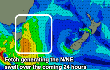
Friday, 24 December 2021
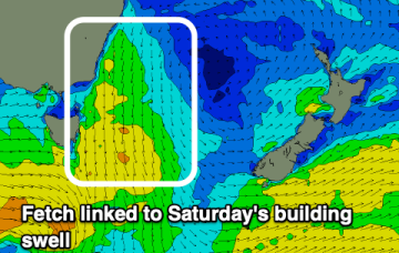
NE windswell looks to build from Thurs, as a dominant high drifts towards New Zealand, allowing winds from the western flank to form a coast hugging fetch south from Jervis Bay.
/reports/forecaster-notes/eastern-tasmania/2021/12/22/few-tasty-windows-coming-over-the-xmas-break
freeride76
Wednesday, 22 December 2021
This swell should hold into Xmas Day, offering up potential for some good, albeit inconsistent surf with prevailing W’ly winds.
/reports/forecaster-notes/eastern-tasmania/2021/12/20/flukey-swell-sources-the-radar-coming-xmas
freeride76
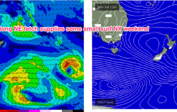
Monday, 20 December 2021
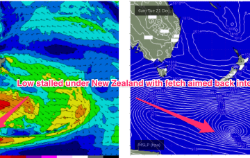
Of more interest is a longer period SE swell being generated from well below the South Island of New Zealand Tues/Wed this week (see below)
/reports/forecaster-notes/eastern-tasmania/2021/12/17/poor-outlook-ahead
Craig
Friday, 17 December 2021
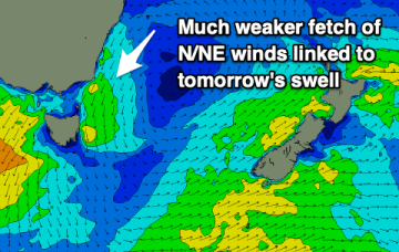
Tomorrow's N/NE windswell has been downgraded further and the coming outlook isn't too exciting.
/reports/forecaster-notes/eastern-tasmania/2021/12/15/smaller-weaker-swells
Craig
Wednesday, 15 December 2021
As the easterly swell energy fades the coming outlook is fairly subdued and weak.
/reports/forecaster-notes/eastern-tasmania/2021/12/13/make-the-most-the-current-swell
Craig
Monday, 13 December 2021
We'll see easing surf over the coming days with nothing too substantial to follow it up, so get stuck in.
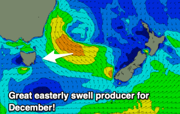
/reports/forecaster-notes/eastern-tasmania/2021/12/10/great-december-easterly-swell
Craig
Friday, 10 December 2021
We've got a sizey easterly swell on the way and it's well worth making the most of even with the slightly dicey winds. There'll be quality waves about.
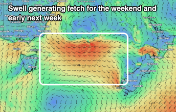
/reports/forecaster-notes/eastern-tasmania/2021/12/08/moderate-large-east-swell-the-weekend
Craig
Wednesday, 8 December 2021
There's an upgrade in the easterly swell due on the weekend with the associated low being stronger and broader in nature.
/reports/forecaster-notes/eastern-tasmania/2021/12/06/good-nne-swell-tomorrow
Craig
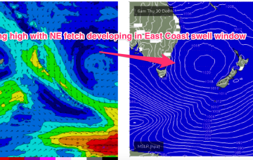
Monday, 6 December 2021
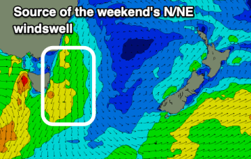
A strengthening fetch of north-east winds are producing a building north-east swell which looks best tomorrow as winds swing offshore and it eases.