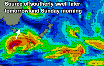
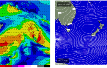
Into the weekend and there’ll continue to be plenty of strong polar frontal activity in our swell window but it’ll be mostly too zonal to generate any major size. Models now show a slightly stronger fetch with a bit more surf potential for S facing beaches on Sunday.
Primary tabs
/reports/forecaster-notes/eastern-tasmania/2022/04/20/small-s-groundswell-pulses-incoming-seasons
freeride76
Wednesday, 20 April 2022
/reports/forecaster-notes/eastern-tasmania/2022/04/18/small-east-followed-small-south
Craig
Monday, 18 April 2022
A slower period but there should be a couple of small waves to surf through this week for the savvy.
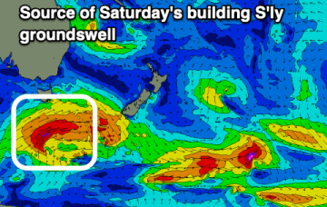
/reports/forecaster-notes/eastern-tasmania/2022/04/15/fun-sly-swell-focus
Craig
Friday, 15 April 2022
Light winds ahead of sea breezes tomorrow with a building S'ly groundswell, cleaner and easing Sunday.
/reports/forecaster-notes/eastern-tasmania/2022/04/13/smaller-surf-new-south-swell-the-weekend
Craig
Wednesday, 13 April 2022
Smaller levels of swell this period but with fun small waves for the right equipment.
/reports/forecaster-notes/eastern-tasmania/2022/04/11/lots-surfing-options-period
Craig
Monday, 11 April 2022
A good mix of swells from the north-east and south with favourable winds.

/reports/forecaster-notes/eastern-tasmania/2022/04/08/ne-swell-over-the-weekend-another-mixed-bag
freeride76
Friday, 8 April 2022
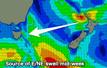
Longer period surf from the E/NE, generated by the long-lived E’ly fetch in the South Pacific, makes landfall on Mon.
/reports/forecaster-notes/eastern-tasmania/2022/04/06/surf-the-s-and-ne-weekend-light-winds
freeride76
Wednesday, 6 April 2022
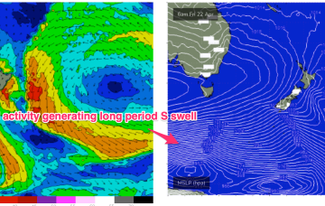
A strong low which passed through the Tasman is also sending a quantum of longer period S to S/SE swell which will see surf heights build from the S to SSE over the next 24-36 hrs.
/reports/forecaster-notes/eastern-tasmania/2022/04/04/mixed-bag-small-s-and-ne-swells-week-better
freeride76
Monday, 4 April 2022
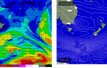
A large cradling fetch of E to SE winds south of the cyclone is better aimed at sub-tropical areas but should still produce some swell for the East Coast of Tasmania early next week.
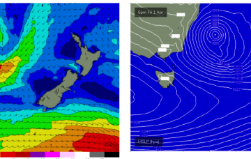
/reports/forecaster-notes/eastern-tasmania/2022/04/01/plenty-surf-and-wind-weekend-conditions
freeride76
Friday, 1 April 2022
A deep Tasman low is expected to reach peak strength through this a’noon, with a general southwards movement favouring ETas, as it places the fetch wrapping into the SE quadrant within the swell window.
/reports/forecaster-notes/eastern-tasmania/2022/03/30/plenty-swell-and-sly-wind-low-winds-nsw-coast
freeride76
Wednesday, 30 March 2022
Severe gale force winds are proximate to the NSW Coast and are well placed to generate plenty of S swell for Tasmania before a better angled ESE to E swell hits on the weekend.