/reports/forecaster-notes/eastern-tasmania/2021/11/26/fun-waves-over-the-weekend-improving-winds-sun
freeride76
Friday, 26 November 2021

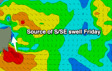
The long, elongated trough line extending off the NSW Coast and angling in a NW/SE orientation towards New Zealand is now located a bit further north than modelled on Wed. Like the last trough system it’s now located more on the Mid North Coast. That amount to a slight downgrade for Eastern Tasmania as the fetch is now located a bit farther north and aimed more at NSW.

/reports/forecaster-notes/eastern-tasmania/2021/11/24/plenty-se-e-swell-upcoming-long-trough-forms-in
freeride76
Wednesday, 24 November 2021

Models are still solid on a major trough line forming in the Tasman as an interior trough exits the Coast on Friday. 

/reports/forecaster-notes/eastern-tasmania/2021/11/22/fun-ne-windswell-week-solid-seese-swell-fri-the
freeride76
Monday, 22 November 2021

This trough is expected to exit the South Coast and form a long SSE angled fetch on Fri as it becomes cradled by a large high moving through the Bight. A pretty classic set-up.

/reports/forecaster-notes/eastern-tasmania/2021/11/19/tiny-weekend-ahead-some-potential-ne-windswell
freeride76
Friday, 19 November 2021

Current model runs suggest the low is further north, and unlikely to exit the coast until late Sun evening or even early Mon. The fetch is now no longer aimed into the Tasmanian swell window so the swell due Sun/Mon, in effect, has been downgraded to almost nothing.

/reports/forecaster-notes/eastern-tasmania/2021/11/17/juicy-ene-swell-ahead-low-moves-gippsland-coast
freeride76
Wednesday, 17 November 2021

Weak fronts are below the country and an inland low is tracking across from WA, tied to the continuing pattern of interior troughiness which is associated with a developing La Nina pattern. This pattern, which has been with us for most of the last few weeks is favourably disposed towards Tasmania for swell production, albeit with some periods of unfavourable winds ahead.

/reports/forecaster-notes/eastern-tasmania/2021/11/15/active-period-ahead-s-and-large-stormy-e-swells
freeride76
Monday, 15 November 2021

An interior low approaches the coast Sun, moving offshore from the Gippsland Coast and intensifying the NE infeed during the day.

/reports/forecaster-notes/eastern-tasmania/2021/11/12/wintry-cold-fronts-s-swell-pulses-mon
freeride76
Friday, 12 November 2021

The next cold front is tied to a complex, mid-latitude low and sees gales sweeping up from the Southern Ocean adjacent to Tasmania on Monday.

/reports/forecaster-notes/eastern-tasmania/2021/11/10/wintry-conditions-and-s-swells-ahead
freeride76
Wednesday, 10 November 2021

The low forming just to the E of Tasmania overnight sees fresh SW to S’ly winds develop through the day, with a quick rise in S swell expected through the day.

/reports/forecaster-notes/eastern-tasmania/2021/11/08/s-swell-pulses-ahead-some-wintry-wly-winds
freeride76
Monday, 8 November 2021

That leads to a couple of days of small, weak surf before the low shifts East of Tasmania on Thursday. 

/reports/forecaster-notes/eastern-tasmania/2021/11/05/ne-swell-sat-easing-quickly-through-sun
freeride76
Friday, 5 November 2021

With reinforcing high pressure now in the Tasman Sea, we’re on track for another round of NE windswell through Sat, as the pressure gradient gets tightened by an approaching trough complex and winds freshen in the East Tasmanian swell window.