/reports/forecaster-notes/southern-tasmania/2021/10/15/poor-tomorrow-improving-thereafter
Craig
Friday, 15 October 2021
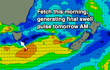
Give tomorrow a miss and aim for a surf over the following days when cleaner conditions and fun surf is still expected.
/reports/forecaster-notes/southern-tasmania/2021/10/13/building-swells-the-weekend-cleanest-early
Craig
Wednesday, 13 October 2021
Tiny surf for the coming days ahead of some new swells into the weekend but with poor conditions. There's one window next week.
/reports/forecaster-notes/southern-tasmania/2021/10/11/nothing-surf-until-the-weekend-onshore-winds
Craig
Monday, 11 October 2021
The coming week will be small to tiny size wise ahead of a stormy S/SE swell this weekend.
/reports/forecaster-notes/southern-tasmania/2021/10/08/tiny-flat-period
Craig
Friday, 8 October 2021
The storm track isn't favourable at all for our region. Try the East Coast Forecaster Notes.
/reports/forecaster-notes/southern-tasmania/2021/10/06/poor-run-surf
Craig
Wednesday, 6 October 2021
There's not much to extract from the coming forecast period. Try the East Coast Forecaster Notes.
/reports/forecaster-notes/southern-tasmania/2021/10/04/fading-sse-swell-and-then-slow
Craig
Monday, 4 October 2021
Nothing too special this period with a fading S/SE swell tomorrow, then tiny ahead of some possible swell from Sunday.
/reports/forecaster-notes/southern-tasmania/2021/10/01/rare-se-swell-incoming
Craig
Friday, 1 October 2021
A slow moving low with multiple embedded troughs will produce a long live SE swell through the coming period.
/reports/forecaster-notes/southern-tasmania/2021/09/29/good-swells-tricky-and-mostly-onshore-winds
Craig
Wednesday, 29 September 2021
There's been a slight improvement to one day this period but otherwise a slow moving low will bring onshore, poor conditions.
/reports/forecaster-notes/southern-tasmania/2021/09/27/good-swells-spoilt-onshore-winds
Craig
Monday, 27 September 2021
There's plenty of swell on the way for the coming week but a deepening and slow moving mid-latitude low will set up across us, bringing onshore winds.
/reports/forecaster-notes/southern-tasmania/2021/09/24/solid-onshore-tomorrow-fun-sunday
Craig
Friday, 24 September 2021
Nothing special tomorrow even with the sizey swell due to the local winds, much better from Sunday.

