Good swells, spoilt by onshore winds
Southern Tasmanian Surf Forecast by Craig Brokensha (issued Monday September 27th)
Best Days: Tuesday morning, possibly Sunday and Monday mornings
Features of the Forecast (tl;dr)
- Fun mid-period SW swell tomorrow with N/NW tending S/SE winds
- Better SW swell building Wed PM but with freshening S/SE winds, easing Thu with stronger E/SE winds
- Reinforcing SW swell Fri with strong E/SE winds, easing Sat with S/SW winds
- SE swell Sat through early next week with possible variable winds Sun and Mon AM
Recap
Snow, cold, onshore and choppy 4ft surf Saturday, much better yesterday with clean conditions and plenty of size still to 3ft.
Today the surf has eased further with fun, clean 1-2ft leftovers.
This week and weekend (Sep 28 – Oct 3)
After the recent run of solid swells the past few weeks, we've still got a bit of energy on the cards for this week owing to a continuation of good polar frontal activity, but winds aren't favourable at all.
We'll see a procession of mid-latitude lows and troughiness clipping the state, bringing unfavourable and persistent winds from the south-eastern quadrant from Wednesday.
 So firstly looking at the coming swell activity and a small, mid-period swell is due tomorrow, generated by weak polar frontal activity south-southwest of Western Australia on the weekend.
Fun waves to 2ft+ are due across Clifton and conditions will be clean with a N/NW offshore ahead of S/SE sea breezes.
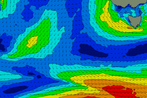
A stronger and much better mid-period SW swell is due Wednesday afternoon's and Thursday morning, with a secondary pulse for Friday as back to back fronts bring strong to near gale-force W'ly winds through our swell window today and over the coming days (right).
Wednesday's swell looks best with sets building to a strong 3ft into the afternoon, easing from a similar size Thursday, with Friday's coming in at 2-3ft.
 The only issue are the local winds, with a broad low moving in from the Bight, squeezing a high just south of us (right), bringing freshening S/SE winds on Wednesday which strengthen from the E/SE on Thursday and persist through Friday.
This will be through the whole swell event, with lingering S/SW winds likely Saturday as the surf eases.
The Southern Ocean storm track will dry up as the mid-latitude systems take hold, and we're likely to see some SE swell spreading up off the slow moving low linked to the poor winds this week. There may be windows of lighter winds in the mornings Sunday and Monday but we'll take a closer look at this Wednesday.

