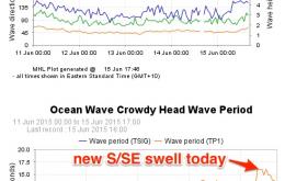
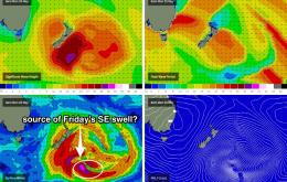
Winds are now already fresh E’ly at Cape Byron which suggests the morning session may not bear much fruit in some areas, even with a reasonably solid swell in the water (however winds are light/variable elsewhere).
Primary tabs
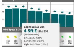
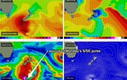
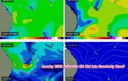
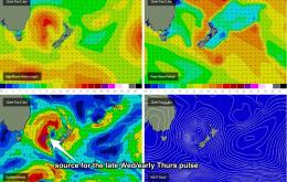
The swell models still have a very strong east swell progged for Saturday however as per Wednesday’s evaluation, I believe that it’s overcooking these heights, by combining two swell trains into one - a short range trade swell off the Coral Sea ridge, and a distant E’ly groundswell from a depression that formed NE of New Zealand earlier in the week.
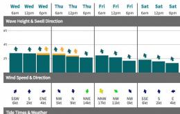
No major change from our eastern swell window for Thursday. The small trade swell that’s occupied our region this week should maintain slow inconsistent sets between 2ft and occasionally 3ft at swell magnets in Far Northern NSW and SE Qld.
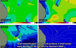
A ridge across the Coral Sea has maintained a reasonable fetch within SE Qld’s eastern swell window since Sunday, and as a result we’re looking at a pulsey trade swell for the next few days north of about Yamba.
The main factor influencing the weekend is a developing trough off the North Coast, which will mainly affect local winds and conditions north of about Coffs Harbour.
As this fetch was working on an already active sea state, and because the fetch tracked northwest then north as it ‘slingshot’ itself around the primary low, we’re going to see another strong pulse of secondary swell fill into the entire East Coast.
South facing beaches in Northern NSW should see strong 6ft+ waves from this event.
As per today, the biggest waves will be across the southern regions (i.e. Mid North Coast), with smaller surf in the Far North and tiny conditions throughout SE Qld.
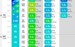
On Friday, we’re still on track for a unique, and probably very good quality SE groundswell for the Mid North Coast.
We’ve got some great waves ahead, especially if you live in Northern NSW.

