/reports/forecaster-notes/south-east-queensland-northern-new-south-wales/2017/11/06/plenty-south
thermalben
Monday, 6 November 2017
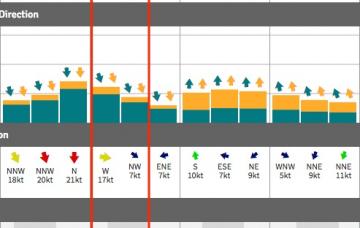
Before we get stuck into surf size estimates, we also need to look at the other dominant factor for the entire week - persistent SE winds.
/reports/forecaster-notes/south-east-queensland-northern-new-south-wales/2017/11/03/fun-weekend
thermalben
Friday, 3 November 2017
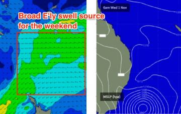
The only real swell source for the weekend will be the existing E’ly swell.
/reports/forecaster-notes/south-east-queensland-northern-new-south-wales/2017/11/01/strong-sly-swell
thermalben
Wednesday, 1 November 2017
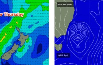
Strong S’ly swells will push across Northern NSW on Thursday, originating from the strongest part of the current Tasman Low.
/reports/forecaster-notes/south-east-queensland-northern-new-south-wales/2017/10/30/complex-week
thermalben
Monday, 30 October 2017
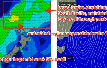
We’ve got a very complex week ahead, with around six individual swell sources - one out of the north, two out of the east and three out of the south.
/reports/forecaster-notes/south-east-queensland-northern-new-south-wales/2017/10/27/tiny-weekend-most
thermalben
Friday, 27 October 2017
Prior to the development of the Tasman Low on Tuesday, we’ll see a new mid-range E’ly swell develop in our eastern swell window.
/reports/forecaster-notes/south-east-queensland-northern-new-south-wales/2017/10/25/fun-peaky-nly
thermalben
Wednesday, 25 October 2017
Thursday’s northerly flow should generate 2-3ft of peaky windswell for exposed locations on Friday morning.
/reports/forecaster-notes/south-east-queensland-northern-new-south-wales/2017/10/23/make-most-tuesday
thermalben
Monday, 23 October 2017
It’s a pretty patchy forecast period ahead.
/reports/forecaster-notes/south-east-queensland-northern-new-south-wales/2017/10/20/windy-south
thermalben
Friday, 20 October 2017
A mix of swells will keep the open beaches active through the start of next week, and relatively light variable winds should allow for clean conditions.
/reports/forecaster-notes/south-east-queensland-northern-new-south-wales/2017/10/18/abating
thermalben
Wednesday, 18 October 2017
Saturday morning is the pick of the forecast period, for SE Qld and perhaps the Tweed and Byron coasts.
/reports/forecaster-notes/south-east-queensland-northern-new-south-wales/2017/10/16/rinse-and-repeat
thermalben
Monday, 16 October 2017
To be honest, the next two days looks like an almost carbon copy of today.

