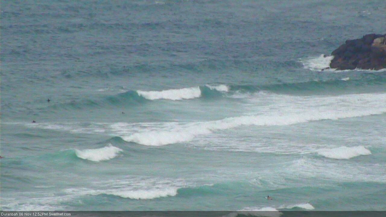
Plenty of south swell and plenty of south-east wind
South-east Queensland and Northern NSW Surf Forecast by Ben Matson (issued Monday 6th November)
Best Days: No great days due to persistent SE winds. Best options are early Tues in SE Qld before the S'ly change hits, otherwise Wed/Thurs/Fri across the outer SE Qld points under a fresh SE breeze (no great size though).
Recap: A lovely east swell delivered solid 3ft sets across many coasts over the weekend. In general, winds were light so conditions were clean though a period of S’ly winds pushed across Northern NSW and into the Gold Coast through Saturday, briefly bumpy up beaches through the middle of the day (though the afternoon saw a rapid improvement). Wave heights are now easing across the region and winds are picking up from the north.

Still some waves at D'Bah this afternoon
This week (Nov 3rd - 6th)
A developing Tasman Low off the Southern NSW coast will push a southerly change up across Northern NSW on Tuesday morning. Ahead of its arrival, winds may briefly swing to the NW then W (across SE Qld) but in general we can expect exposed beaches to become blown out as the southerly strengthens.
The current E’ly swell will continue a slow decline through Tuesday and Wednesday though should still maintain some fun small waves about those beaches offering protection from the southerly.
Otherwise, we’re looking at a strong, prolonged round of southerly swell across the Northern NSW coast, with much smaller surf pushing north of the border.
The Tasman Low looks very impressive on paper but it’s actually going to move quickly to the east. As such, it’ll have a relatively low level of influence on our surf potential from Tuesday onwards - the main source of swell will be related to a series of strong fronts moving up from polar latitudes.
However before we get stuck into surf size estimates, we also need to look at the other dominant factor for the entire week - a strong ridge pushing across Southern Qld and a slow moving trough of low pressure between New Caledonia and Fiji will drive fresh S/SE thru’ SE winds across most coasts all the way through the weekend. So, the only surfable options will be at protected points.
Tuesday afternoon will see an initial early peak in S/SE swell from the Tasman Low across Northern NSW (though accompanied by strong southerly winds). Expect leftover 2-3ft sets early morning, building to 4-5ft at south facing beaches by late in the day. However, we won’t see much surf from the south across SE Qld on Tuesday. Confidence on precise wave heights is not high; we may see 40-50kts around the core of the low but the fetch length will be very short so I’m not actually expecting a great deal of relative size.
Wave heights will then level through Wednesday morning around a bumpy 3-5ft at south facing beaches south of Byron, smaller at remaining beaches and only 1-2ft across outer SE Qld points (bigger but wind affected at exposed northern ends).
After lunch Wednesday, and new long period S’ly groundswell will reach the Mid North Coast and may push across the Far North Coast late in the day, but it’ll show better through Thursday morning. This swell will originate from a polar low and front pushing south of Tasmania today, and south facing beaches south of Byron should see occasional 4-6ft sets.
Unfortunately, with fresh SE winds the only rideable options will be at protected southern corners where it’ll be much smaller. SE Qld will also see only a couple of feet of swell (i.e. 2ft+) across the outer points, from both the southerly groundswell and some short range S/SE energy from the local fetch. Exposed northern ends should see another foot or two but they won’t be surfable with these winds.
Continuing SE winds and slowly easing swells will then pad out Friday.
This weekend (Nov 7th - 8th)
It’s not a great weekend forecast, but there’ll be waves. We’ll see persistent fresh SE winds across all coasts both days, and the southerly groundswells from the middle of this week will ease right back.
As such the surf we’ll see will consist of short range energy form the local fetch and some mid-range energy from a weak change moving through the eastern Tasman Sea on Friday that’ll strengthen a S/SE fetch and should ultimately provide a small boost in size through late Saturday and early Sunday.
South swell magnets in Northern NSW may also pick up a small new south swell late Saturday and Sunday, from a strong Southern Ocean front pushing under Tasmania Thurs/Fri.
We probably won’t see much more than 2ft, maybe 2-3ft across outer points but they’ll be your best option. Otherwise, south facing beaches south of Byron will see larger but much bumpier waves.
Next week (Nov 9th onwards)
The long term potential shows easing SE winds across the coast early next week, and an easing southerly swell regime. The long range fantasy charts still have a deepening trough south of Fiji mid-late next week, but it’ll be many days until there’s any kind of confidence for a resulting easterly swell from it.


Comments
ECs on board to some extent with that GFS fantasy chart. Certainly something to look forward to so early in the season.
That dip..... I'll go out on a limb and call it. I have my reasons for calling. But hey... It's old school guru bullshit bahahaha.
No guts no glory lol
So Sheepy what are you calling it....?
I agree SD....that dip looks better and better every run, especially GFS.
down with the ship if it tanks.
Holy shee-it........AccessG (BOM) have come onboard in a big, big way.
ECM showing nice NNW directed fetch from eastern Tasman, great for Sols.
Surfline still not seeing it, just straight N fetch from western Tasman
yeah that last Access run looking damn fine