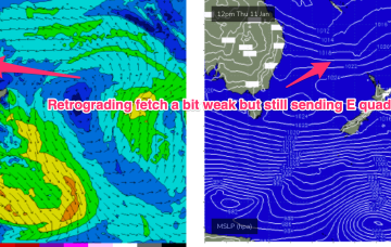
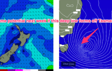
The compact low near Tasmania is now skipping away to the SE with a large high SE of the South Island (1034 hPa) interacting with a broad low pressure trough in the South Pacific which will supply E’ly quadrant swell in the near term as the low pressure trough retrogrades back towards the east coast.
Primary tabs
/reports/forecaster-notes/south-east-queensland-northern-new-south-wales/2024/01/10/boost-in-e-swell
freeride76
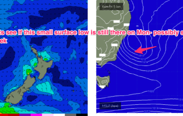
Wednesday, 10 January 2024
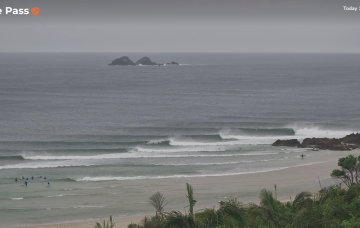
/reports/forecaster-notes/south-east-queensland-northern-new-south-wales/2024/01/08/fun-sized-ely
freeride76
Monday, 8 January 2024
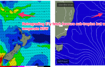
Once the Tasmania low clears there picture we’ll see monsoonal activity develop through the South Pacific/Coral Sea, likely with a broad area of low pressure squeezing pressure gradients along a long fetch between the North Island and near Island chains and retrograding back towards the East coast through the second half of this week.
/reports/forecaster-notes/south-east-queensland-northern-new-south-wales/2024/01/05/another-fun-round
freeride76
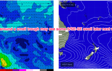
Friday, 5 January 2024
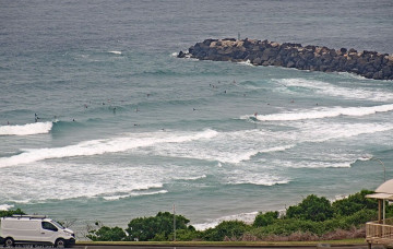
Surf-wise the fetch off the top of the high and a broad troughy area, holds another round of E’ly quadrant swell in the 2-3ft range, very similar to the last round. Quality will be wind affected but we should see light enough winds in the morning for glassy lightly wind affected surf.
/reports/forecaster-notes/south-east-queensland-northern-new-south-wales/2024/01/03/peelers-the
freeride76
Wednesday, 3 January 2024
Not a great deal of change since Mon with a slow moving, weakening high in the Tasman, and a coastal trough off the QLD Coast (responsible for hundreds of mm of rainfall) now moving away and dissipating. A trough moving north from a position east of Tasmania brings a renewal of the S’ly pattern into Fri before the summer pattern slowly resets over the weekend.

/reports/forecaster-notes/south-east-queensland-northern-new-south-wales/2024/01/01/workable-mediocre
freeride76
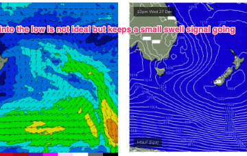
Monday, 1 January 2024
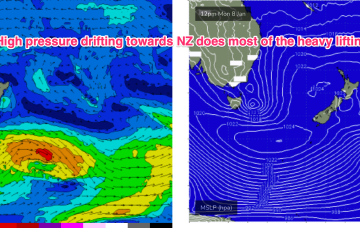
We’ve got a moderate strength high pressure cell (1025hPa) in the Tasman, connected to a high pressure belt under the continent, directing NE winds in Central/Southern NSW, more E-SE in the sub-tropics where a broad troughy area is directing a stronger onshore flow and whipping up local swells from that direction.
/reports/forecaster-notes/south-east-queensland-northern-new-south-wales/2023/12/29/outlook-looking
freeride76
Friday, 29 December 2023
No great change to the weekend f/cast. Just a small, weak mixed bag of leftover S swells and E swells to 1-2ft at best Sat, similar or smaller Sun.
/reports/forecaster-notes/south-east-queensland-northern-new-south-wales/2023/12/27/very-low-energy
freeride76
Wednesday, 27 December 2023
Elsewhere, it’s a bland pattern with a dormant Coral Sea. Cold fronts later this week and over the weekend will supply some minor S swell favouring NENSW S facing beaches.
/reports/forecaster-notes/south-east-queensland-northern-new-south-wales/2023/12/25/workable-waves
freeride76
Monday, 25 December 2023
For our sub-tropical region the main swell source will be a proximate N’ly fetch extending up to water adjacent to the CQ coast and holding a workable NE windswell.
/reports/forecaster-notes/south-east-queensland-northern-new-south-wales/2023/12/22/make-the-most
thermalben
Friday, 22 December 2023
An approaching inland trough will freshen northerlies about most coasts on Sunday, so make the most of Saturday.
/reports/forecaster-notes/south-east-queensland-northern-new-south-wales/2023/12/20/plenty-east-swell
thermalben
Wednesday, 20 December 2023
We’ve got building trade swells for the next few days, and a weakening synoptic pattern in the north, that will result in light variable winds and sea breezes in most northern areas.