/reports/forecaster-notes/south-east-queensland-northern-new-south-wales/2015/02/16/large-windy-waves
thermalben
Monday, 16 February 2015
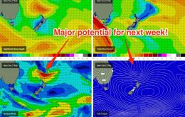
We’re probably looking at the most active week of the summer swell season so far.
/reports/forecaster-notes/south-east-queensland-northern-new-south-wales/2015/02/13/extended-period
thermalben
Friday, 13 February 2015
The outlook for the next few days is for a repeat of what we’ve seen over the last few days.
/reports/forecaster-notes/south-east-queensland-northern-new-south-wales/2015/02/11/more-same
thermalben
Wednesday, 11 February 2015
More of the same is expected for the next few days.
/reports/forecaster-notes/south-east-queensland-northern-new-south-wales/2015/02/09/excellent-outlook
thermalben
Monday, 9 February 2015
Freshening SE winds through the Coral Sea will kick up some new short range swell for southern Qld over the coming days.
/reports/forecaster-notes/south-east-queensland-northern-new-south-wales/2015/02/06/fun-weekend-waves
thermalben
Friday, 6 February 2015
No major changes to the weekend outlook. And, the long term forecast looks excellent.
/reports/forecaster-notes/south-east-queensland-northern-new-south-wales/2015/02/04/downgraded-still
thermalben
Wednesday, 4 February 2015
SE Qld will be relying on the fading leftovers of groundswell from TC Ola on Thursday, plus short range SE energy from the building ridge.
/reports/forecaster-notes/south-east-queensland-northern-new-south-wales/2015/02/02/building-swells
thermalben
Monday, 2 February 2015
For those non-travellers out there, ‘Ola’ is Spanish for ‘waves’, which has gotta mean something, right?
/reports/forecaster-notes/south-east-queensland-northern-new-south-wales/2015/01/30/directional-south
thermalben
Friday, 30 January 2015
We’ve got quite a complex weekend to forecast for across this region.
/reports/forecaster-notes/south-east-queensland-northern-new-south-wales/2015/01/27/building-swell
thermalben
Tuesday, 27 January 2015
As for Friday - it’s a simple matter of up, up up during the day. But the key is: when?
/reports/forecaster-notes/south-east-queensland-northern-new-south-wales/2015/01/23/steadily
thermalben
Friday, 23 January 2015
It’s hard to make a judgement call on the weekend’s prospective surf outlook because regardless of local winds and swell trends, the previous few days rain activity will have a reasonable bearing on the surf quality.


