/reports/forecaster-notes/south-east-queensland-northern-new-south-wales/2014/12/26/uninspiring
thermalben
Friday, 26 December 2014
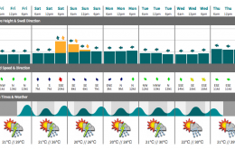
The computer models have been shifting around the position of the weekend’s North Coast ridge, so the corresponding forecast now has a little less confidence than a few days ago.
/reports/forecaster-notes/south-east-queensland-northern-new-south-wales/2014/12/24/fun-waves-exposed
thermalben
Wednesday, 24 December 2014
Christmas Day looks OK for an average afternoon session.
/reports/forecaster-notes/south-east-queensland-northern-new-south-wales/2014/12/22/lotsa-small-long
thermalben
Monday, 22 December 2014
Not a great deal to get excited about in the short term, but we will certainly see an improvement over the last few days.
/reports/forecaster-notes/south-east-queensland-northern-new-south-wales/2014/12/19/wide-variety
thermalben
Friday, 19 December 2014
You’ll have to aim for an early session at the beaches while winds are lightest (keep your expectations low).
/reports/forecaster-notes/south-east-queensland-northern-new-south-wales/2014/12/17/multiple-swell
thermalben
Wednesday, 17 December 2014
As such, we’re not looking at much swell energy north of (about) Coffs Harbour from this source, and what energy does arrive will probably peak overnight Thursday.
/reports/forecaster-notes/south-east-queensland-northern-new-south-wales/2014/12/15/several-fun
thermalben
Monday, 15 December 2014
Plenty of swell for the rest of the week - you’ll just have to work around the winds.
/reports/forecaster-notes/south-east-queensland-northern-new-south-wales/2014/12/12/great-weekend
thermalben
Friday, 12 December 2014
Looking very good overall, especially after a couple of months of annoying northerlies!
/reports/forecaster-notes/south-east-queensland-northern-new-south-wales/2014/12/10/pumping-waves
thermalben
Wednesday, 10 December 2014
We’ve got a developing low off the southern NSW coast on Thursday that’ll dictate our surf, wind and weather for the following couple of days.
/reports/forecaster-notes/south-east-queensland-northern-new-south-wales/2014/12/08/complex-period
thermalben
Monday, 8 December 2014
This developing trough looks like it will finally break the recent pattern of persistent northerly winds across the East Coast.
/reports/forecaster-notes/south-east-queensland-northern-new-south-wales/2014/12/05/southerly-change
thermalben
Friday, 5 December 2014
No change to the weekend forecast - northerlies will generally ruin the surf at most locations.

