The weekend looks potentially very fun at this stage as we finally see a return to typical summer winds and swells.
Primary tabs
The weekend looks pretty poor for surfers of all persuasions. But, there's stacks of swell sources on the charts for the long term. More in the Forecaster Notes.
There is one swell worth keeping an eye out for. More in the Forecaster Notes.
Let's cut to the chase for the bulk of this week: it looks very small, and very lacklustre for most coasts, and the northerly breeze will be up Tuesday and Wednesday too. There are some windows of opportunity though.
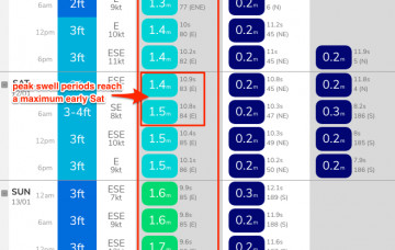
The forecast charts don’t show much, but SE Qd will see a small increase in mid range E/NE swell over the coming days.
The dawn patrol may not be the best window of opportunity as it may not have properly cleaned up from lingering overnight cross-onshore winds. More in the Forecaster Notes.
It looks like we’re heading back to that previous synoptic pattern from a few weeks ago. More in the Forecaster Notes.
Based on model guidance, we’re yet to see the peak swell energy from TC Mona.
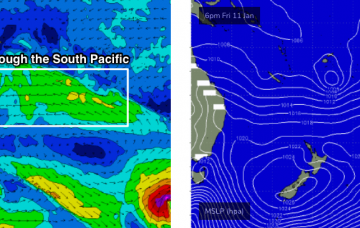
We have an increase in store out of the east courtesy of TC Mona, which has been lingering near Fiji all week. More in the forecaster Notes.
Feels like we’re about to see Groundhog Day for a little while longer yet, with this same pattern of easterly swells and light variable tending light to moderate onshore winds across SE Qld and Far Northern NSW.

