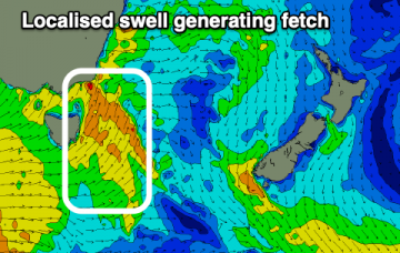
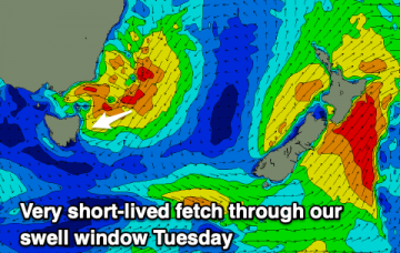
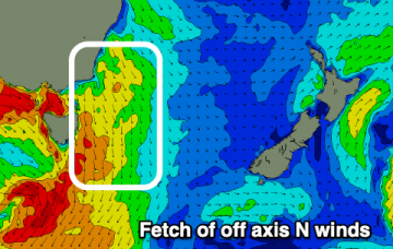
As a cold front approaches Wed, NNW’ly winds freshen adjacent to the NSW coast and out into the Tasman sea. This is expected to generate a small 2ft NE windswell late Wed
Primary tabs
/reports/forecaster-notes/eastern-tasmania/2021/08/09/small-ne-windswell-flush-wed-another-s-swell
freeride76
Monday, 9 August 2021
/reports/forecaster-notes/eastern-tasmania/2021/08/06/fun-s-swell-sat-not-much-after
freeride76
Friday, 6 August 2021
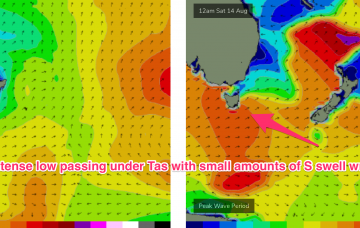
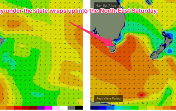
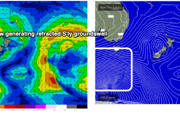
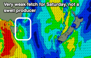
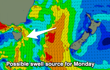
Still on track for fun S’ly groundswell Saturday generated by an intense polar low with a mostly W’ly fetch and a better angled following front with a more favourable SW fetch
/reports/forecaster-notes/eastern-tasmania/2021/08/04/easing-e-swells-new-s-swell-the-weekend
freeride76
Wednesday, 4 August 2021
Still on track for fun S’ly groundswell Saturday generated by an intense polar low with a mostly W’ly fetch and a better angled following front with a more favourable SW fetch.
/reports/forecaster-notes/eastern-tasmania/2021/08/02/fun-pulses-the-east-then-south-the-weekend
Craig
Monday, 2 August 2021
A bit to work around this period with a fun swell from the east ahead of south swells on the weekend.

/reports/forecaster-notes/eastern-tasmania/2021/07/30/minimal-surf-possibilities
Craig
Friday, 30 July 2021
There's nothing of note still on the cards this forecast period with no swells of size or strength.
/reports/forecaster-notes/eastern-tasmania/2021/07/28/make-the-most-today
Craig
Wednesday, 28 July 2021
Make the most of today's acute N/NE swell as there's nothing on the cards really for the rest of the period.
/reports/forecaster-notes/eastern-tasmania/2021/07/26/choppy-northerly-swell-the-best-it
Craig
Monday, 26 July 2021
The outlook remains poor with a bit of swell due from the north mid-week but with poor winds.
/reports/forecaster-notes/eastern-tasmania/2021/07/23/quiet-period-continues
Craig
Friday, 23 July 2021
The coming forecast period remains quiet with only a couple of flukey swells on the cards.
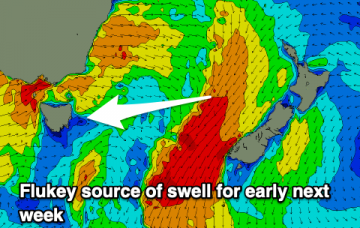
/reports/forecaster-notes/eastern-tasmania/2021/07/21/tiny-flat-outlook-one-possible-flukey-swell
Craig
Wednesday, 21 July 2021
The outlook is void of any reliable swell sources, but there is one flukey one to keep an eye on for early next week.
/reports/forecaster-notes/eastern-tasmania/2021/07/19/small-fleeting-south-pulse
Craig
Monday, 19 July 2021
We'll see a burst of strong southerly winds up the coast bringing a brief increase in S'ly swell which will be best as it eases.