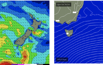
Sunday looks a little juicier as the large fetch of gales passes into the Tasman generating a stronger S swell.
Primary tabs
/reports/forecaster-notes/eastern-tasmania/2023/10/11/few-small-pulses-the-s-strongest-sun
freeride76
Wednesday, 11 October 2023
/reports/forecaster-notes/eastern-tasmania/2023/10/09/small-pulses-southerly-groundswell
Craig
Monday, 9 October 2023
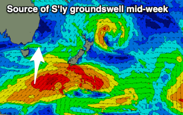
The coming week will see ebbs and pulses of S'ly groundswell on the south magnets.
/reports/forecaster-notes/eastern-tasmania/2023/10/06/fun-south-swell-pulses-the-coming-days
Craig
Friday, 6 October 2023
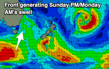
The south magnets will be the pick over the coming days for a surf with fun pulse of south energy.
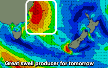
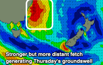
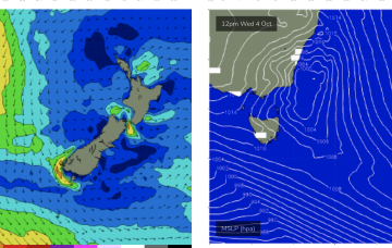
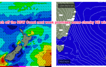
/reports/forecaster-notes/eastern-tasmania/2023/10/04/secondary-strong-ne-groundswell-come
Craig
Wednesday, 4 October 2023
One down, one to go.
/reports/forecaster-notes/eastern-tasmania/2023/10/02/large-north-east-pulses-come-week
Craig
Monday, 2 October 2023
We've got a very dynamic and exciting week of swell and winds ahead.
/reports/forecaster-notes/eastern-tasmania/2023/09/29/looks-some-real-size-the-ne-next-week
freeride76
Friday, 29 September 2023
Into the new week and it still looks dynamic with several strong N’ly fetches.
/reports/forecaster-notes/eastern-tasmania/2023/09/27/small-surf-continues-over-the-weekend-some
freeride76
Wednesday, 27 September 2023
Small, combination swells and some light wind periods pad out the rest of the week with a more entrenched N’ly episode next week with solid NE swell expected.
/reports/forecaster-notes/eastern-tasmania/2023/09/25/another-week-small-swells-juicier-ne-swell-the
freeride76
Monday, 25 September 2023
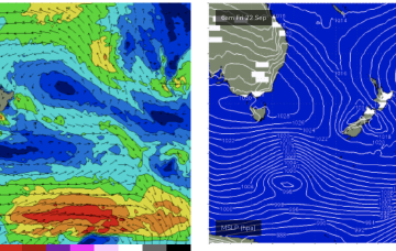
We’ve got a small fetch out of Cook Strait at present from a decaying low pressure system, and small, compact low about to enter the Tasman bringing todays S’ly change and a S swell tomorrow. A stronger front late this week will supply a modest S pulse heading into the weekend.

/reports/forecaster-notes/eastern-tasmania/2023/09/22/remaining-small-just-few-bits-and-pieces-the
freeride76
Friday, 22 September 2023
Into next week and no major swell sources on the radar. High pressure moves NE into the Tasman with as N’ly fetch off the NSW S Coast likely to generate some small NE windswell Mon.

/reports/forecaster-notes/eastern-tasmania/2023/09/20/low-energy-outlook-so-grab-what-you-can
freeride76
Wednesday, 20 September 2023
Small fronts and lows bring some minor S swell pulses to the NE corner later this week, before high pressure drifts across the Island and brings calm conditions. A few small swell sources are possible but in general we’re looking at a quiet period.