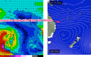
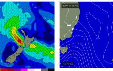
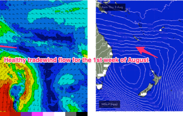
We’re now seeing a high pressure surge with building tradewinds across the Coral Sea. The fetch is a little disjointed, which does tap a bit off the size but we’ll still see some rideable 1-2ft surf develop through Tues/Wed.
Primary tabs
/reports/forecaster-notes/central-queensland/2023/08/21/rideable-waves-in-sight-possibly-extending
freeride76
Monday, 21 August 2023
/reports/forecaster-notes/central-queensland/2023/08/18/end-flat-spell-in-sight-some-fun-waves-mid
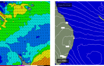
freeride76
Friday, 18 August 2023
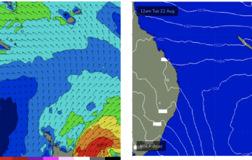
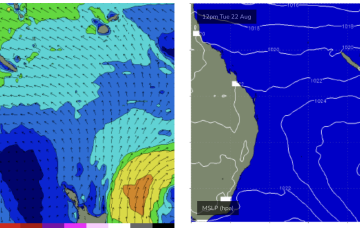
We should see an end to the flat spell by Tues next week, with a high pressure ridge building up the QLD coast and Tradewinds forming a broad fetch through the Southern/Central Coral Sea.
/reports/forecaster-notes/central-queensland/2023/08/14/tinyflat-surf-week
freeride76
Monday, 14 August 2023
With no swell sources on tap for CQ we’re looking at a tiny/flat week, par for the course for this time of year.
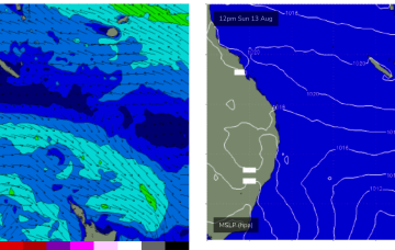
/reports/forecaster-notes/central-queensland/2023/08/11/tinyflat-surf-next-week
freeride76
Friday, 11 August 2023
With the tradewind belt weakening and contracting northwards we’re seeing tiny/flat surf establish in CQ waters.
/reports/forecaster-notes/central-queensland/2023/08/09/surf-becoming-tiny-the-weekend-flat-spell
freeride76
Wednesday, 9 August 2023
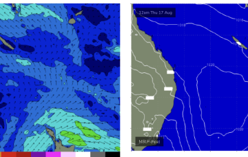
High pressure (1031hPa) is slowly but surely moving into the Tasman in a NE direction pushing a decaying tradewind flow further north and leading to easing surf across CQ after a great run of waves.
/reports/forecaster-notes/central-queensland/2023/08/07/easing-tradewind-swells-becoming-tiny-week
freeride76
Monday, 7 August 2023
A persistent tradewind fetch is in the process of resetting with a less favourable wind alignment and easing swells.
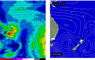
/reports/forecaster-notes/central-queensland/2023/08/04/great-winter-waves-over-the-weekend
freeride76
Friday, 4 August 2023
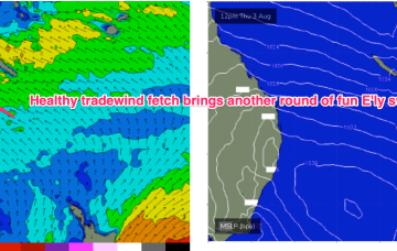
No great change to the weekend f/cast. Current ASCAT (satellite windspeed) passes show a very healthy fetch of SE-E/SE tradewinds extending through the Central/Southern Coral Seas with plenty of fun E’ly tradewind swell expected over the weekend. Size in the 2-3ft range is expected and this should hold right through the weekend.
/reports/forecaster-notes/central-queensland/2023/08/02/great-run-surf-now-beginning
freeride76
Wednesday, 2 August 2023
Rapidly building swells across the region as a major SE surge builds up the QLD Coast.
/reports/forecaster-notes/central-queensland/2023/07/31/another-round-really-fun-waves-week
freeride76
Monday, 31 July 2023
Once the dominant high enters the Tasman on Wed we’ll see a SE’ly to E'ly tradewind pattern start to establish through the Coral Sea, more typical of Summer, likely extending into the weekend with plenty of workable tradewind swell associated with it.
/reports/forecaster-notes/central-queensland/2023/07/28/easing-surf-over-the-weekend-great-outlook
freeride76
Friday, 28 July 2023
A large high sets up a very useful tradewind flow across the Central and Southern Coral Sea next week, generating a very handy tradewind swell for the sub-tropics through from Wed next week and into the weekend.