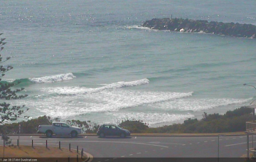
Let's cut to the chase for the bulk of this week: it looks very small, and very lacklustre for most coasts, and the northerly breeze will be up Tuesday and Wednesday too. There are some windows of opportunity though.
Primary tabs
/reports/forecaster-notes/south-east-queensland-northern-new-south-wales/2019/01/21/not-particularly
thermalben
Monday, 21 January 2019
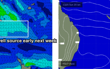
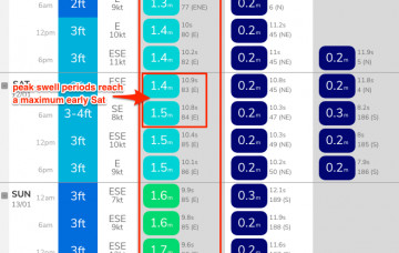
/reports/forecaster-notes/south-east-queensland-northern-new-south-wales/2019/01/18/small-lacklustre
thermalben
Friday, 18 January 2019
The forecast charts don’t show much, but SE Qd will see a small increase in mid range E/NE swell over the coming days.
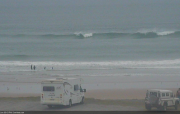
/reports/forecaster-notes/south-east-queensland-northern-new-south-wales/2019/01/16/enjoy-last-gasps
thermalben
Wednesday, 16 January 2019
The dawn patrol may not be the best window of opportunity as it may not have properly cleaned up from lingering overnight cross-onshore winds. More in the Forecaster Notes.

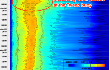
/reports/forecaster-notes/south-east-queensland-northern-new-south-wales/2019/01/14/just-another
thermalben
Monday, 14 January 2019
It looks like we’re heading back to that previous synoptic pattern from a few weeks ago. More in the Forecaster Notes.

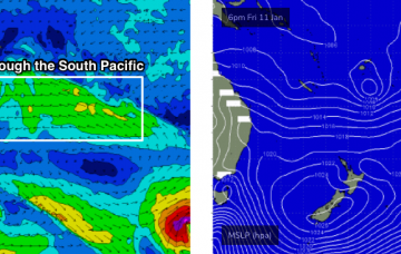
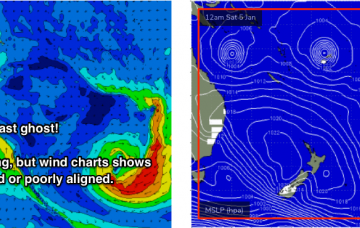
/reports/forecaster-notes/south-east-queensland-northern-new-south-wales/2019/01/11/another-week
thermalben
Friday, 11 January 2019
Based on model guidance, we’re yet to see the peak swell energy from TC Mona.
/reports/forecaster-notes/south-east-queensland-northern-new-south-wales/2019/01/09/just-change-weve
thermalben
Wednesday, 9 January 2019
We have an increase in store out of the east courtesy of TC Mona, which has been lingering near Fiji all week. More in the forecaster Notes.
/reports/forecaster-notes/south-east-queensland-northern-new-south-wales/2019/01/07/continuing
thermalben
Monday, 7 January 2019
Feels like we’re about to see Groundhog Day for a little while longer yet, with this same pattern of easterly swells and light variable tending light to moderate onshore winds across SE Qld and Far Northern NSW.
/reports/forecaster-notes/south-east-queensland-northern-new-south-wales/2019/01/04/endless-summer
thermalben
Friday, 4 January 2019
TC Penny is not a direct swell producer for our region, but an indirect source of energy, albeit good quality and long-lived. Oh, and TC Mona out near Fiji looks like providing a large E'ly groundswell next week. More in the Forecaster Notes.
/reports/forecaster-notes/south-east-queensland-northern-new-south-wales/2019/01/02/continual-trade
thermalben
Wednesday, 2 January 2019
The main fetch around TC Penny will be aimed towards Central and Northern Qld coasts, but its slow moving nature and broad width should favour a good spread of energy southwards.
/reports/forecaster-notes/south-east-queensland-northern-new-south-wales/2018/12/31/no-shortage-surf
thermalben
Monday, 31 December 2018
We're in the midst of a particularly active period, especially for those surfers north of the border.
