We’ve had an improvement in the outlook for the next few days.
Primary tabs
We’ve got building swells on the cards for the rest of the week, thanks to a slow moving Tasman high. The main issue we have this week are local winds.
A deepening trough to our north-east is expected to spawn a possible tropical cyclone by mid-week (between Vanuatu and Fiji).
Two southerly changes are pushing up the NSW Coast. And it looks like we’ve got an extended period of E'ly swell on the cards as a blocking pattern sets up camp. More in the Forecaster Notes.
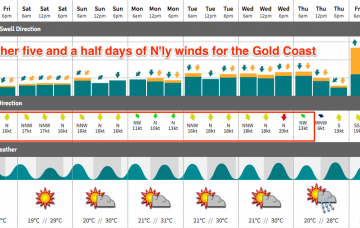
Strengthening N’ly winds are going to dominate the next few days.
Can’t say I’m terribly enthusiastic about the weekend outlook, though there is potential for a few windows of opportunity.
Strengthening northerly winds are really going to create some problems.
Wave heights are still strong though slowly easing across Southern NSW, so we can expect a similar (though delayed) trend in our neck of the woods. More in the Forecaster Notes.
Sunday’s southerly change will be linked in with a reasonable low, and a series of secondary fronts trailing behind will also provide useful south swell through the first half of next week. More in the Forecaster Notes.
Looks like a tricky weekend ahead with variable conditions ahead of a gusty southerly change on Sunday afternoon that’ll eventually generate a decent south swell for early next week.

