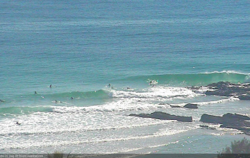
Make the most of Thursday morning. And it looks like a tricky weekend ahead.
Primary tabs
/reports/forecaster-notes/south-east-queensland-northern-new-south-wales/2018/09/05/easing-swells-and
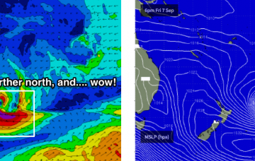
thermalben
Wednesday, 5 September 2018
/reports/forecaster-notes/south-east-queensland-northern-new-south-wales/2018/09/03/bumpy-trade
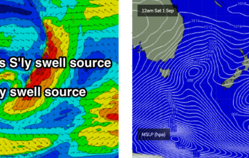
thermalben
Monday, 3 September 2018
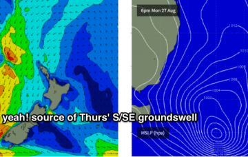
There’s a few sources of swell this week. And some really major systems firing up just outside of our swell window.
/reports/forecaster-notes/south-east-queensland-northern-new-south-wales/2018/08/31/fun-brief-ne
thermalben
Friday, 31 August 2018
The model guidance for the rest of next week is all over the shop.
/reports/forecaster-notes/south-east-queensland-northern-new-south-wales/2018/08/29/strong-swells
thermalben
Wednesday, 29 August 2018
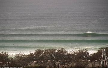
Confidence is reasonably high for how this event will pan out across Northern NSW into Thursday, though any energy out of the south always throws a curveball relative to SE Qld.

/reports/forecaster-notes/south-east-queensland-northern-new-south-wales/2018/08/27/powerful-swells
thermalben
Monday, 27 August 2018
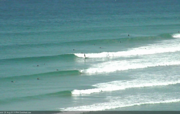
There’s a lot of strong swell on the way this week, though it’ll be very south in direction and will therefore create a wide range in heights between Northern NSW and South-east Queensland beaches.
/reports/forecaster-notes/south-east-queensland-northern-new-south-wales/2018/08/24/average-weekend
thermalben
Friday, 24 August 2018
Lots of peaky options for the next few days ahead of another round of S'ly swell next week.
/reports/forecaster-notes/south-east-queensland-northern-new-south-wales/2018/08/22/more-swell-out-se
thermalben
Wednesday, 22 August 2018
The timing on each phase of energy from this pattern isn’t very clear as it’s not a frequently active swell window, so we need some elasticity on this energy as we move into Friday.
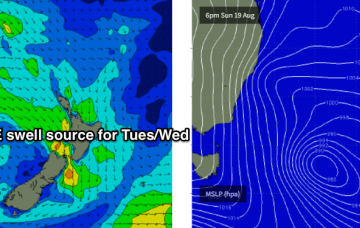
/reports/forecaster-notes/south-east-queensland-northern-new-south-wales/2018/08/20/stacks-swell
thermalben
Monday, 20 August 2018
Waves, waves, waves - first the south, then south-east and then some potential out of the north-east too. Lots of options throughout the entire period.
/reports/forecaster-notes/south-east-queensland-northern-new-south-wales/2018/08/17/lots-southerly
thermalben
Friday, 17 August 2018
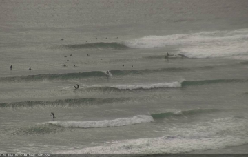
Obviously, with ideal winds out of the south, all road should lead to the SE Qld points. By and large, they will be your best bet but we need to factor in a significant drop in size because of the generally low periods and southerly swell direction.
/reports/forecaster-notes/south-east-queensland-northern-new-south-wales/2018/08/15/extended-round
thermalben
Wednesday, 15 August 2018
The big question mark for Thursday is the long range east swell that’s been discussed in this notes for the last week or two.