We’ve got a bog standard south swell ahead for the weekend. Expect a delay on the upwards phase of this swell in the Far North through Saturday.
Primary tabs
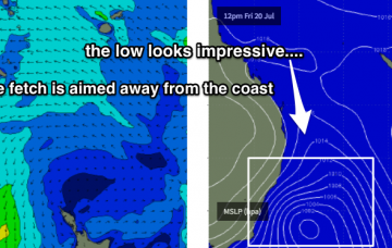
/reports/forecaster-notes/south-east-queensland-northern-new-south-wales/2018/07/20/extended-period
thermalben
Friday, 20 July 2018

/reports/forecaster-notes/south-east-queensland-northern-new-south-wales/2018/07/18/aside-brief-south
thermalben
Wednesday, 18 July 2018
Model guidance still has a strong front tracking through the lower Tasman Sea overnight Friday but recent runs have tweaked the alignment more towards a zonal pattern (west-east), which has downgraded our surf potential.

/reports/forecaster-notes/south-east-queensland-northern-new-south-wales/2018/07/16/tricky-swells
thermalben
Monday, 16 July 2018
There’s still around three feet of leftover southerly swell across Southern NSW this afternoon, so we can look forward to a similar round of energy across Northern NSW on Tuesday morning.
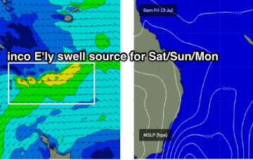
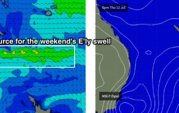
/reports/forecaster-notes/south-east-queensland-northern-new-south-wales/2018/07/13/building
thermalben
Friday, 13 July 2018
The weekend looks reasonably fun all round.
/reports/forecaster-notes/south-east-queensland-northern-new-south-wales/2018/07/11/easing-swells
thermalben
Wednesday, 11 July 2018
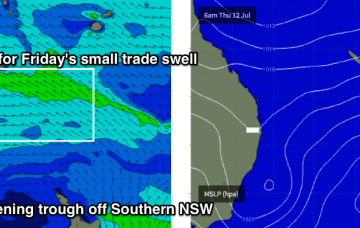
These troughs/lows that develop close to the Southern NSW coast and remain slow moving are always tricky for swell potential.
/reports/forecaster-notes/south-east-queensland-northern-new-south-wales/2018/07/09/strong-sly-swell
thermalben
Monday, 9 July 2018
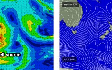
With wave heights expected to reach a brief peak overnight under the cover of darkness, Tuesday morning should still see slightly larger surf than what we’ve seen today.
/reports/forecaster-notes/south-east-queensland-northern-new-south-wales/2018/07/06/great-beachbreaks
thermalben
Friday, 6 July 2018
Today’s easing trade swell will continue its downwards trend into the weekend, but winds will swing W/NW across northern regions and W/SW across southern regions, resulting in clean beachbreaks.
/reports/forecaster-notes/south-east-queensland-northern-new-south-wales/2018/07/04/plenty-swell
thermalben
Wednesday, 4 July 2018
The next few days look a little suss with E/NE winds tending NE then eventually N’ly, freshening all the while.

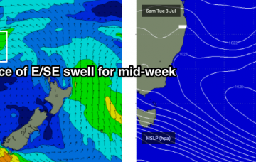
/reports/forecaster-notes/south-east-queensland-northern-new-south-wales/2018/07/02/nice-round-se
thermalben
Monday, 2 July 2018
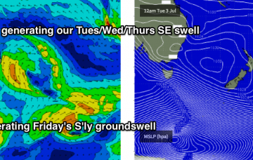
There’s been some interesting upgrades in the model guidance for this Far North Coast low over the last few days.
/reports/forecaster-notes/south-east-queensland-northern-new-south-wales/2018/06/29/small-easing
thermalben
Friday, 29 June 2018
There’s not a great deal of size or strength expected for the weekend, though Saturday will offer the best surf of the next few days