Plenty of trade swell all week with much larger surf possible as TC Alfred moves south through Coral Sea
Monday, 24 February 2025

Plenty of trade swell all week with much larger surf possible as TC Alfred moves south through Coral Sea
Monday, 24 February 2025
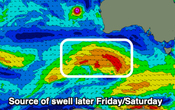
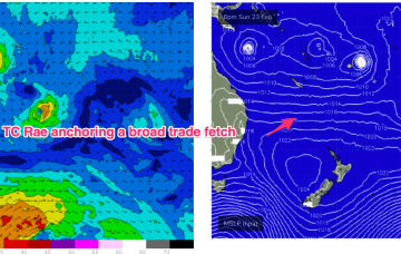
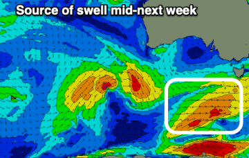
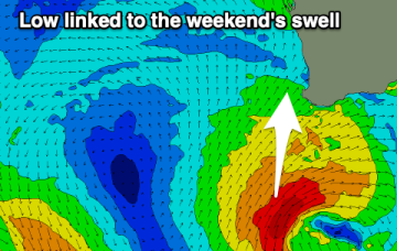
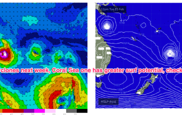
A very long and broad tradewind fetch is anchored on a NW/SE axis by twin tropical cyclones. TC Alfred is meandering in the Coral Sea NE of Cairns, while TC Rae is NW of Fiji and moving south-south westwards.