Small but surfable swells for the week, mostly into Thursday.
Primary tabs
/reports/forecaster-notes/eastern-tasmania/2023/03/13/small-swells-the-week
Craig
Monday, 13 March 2023
/reports/forecaster-notes/eastern-tasmania/2023/03/10/wintry-pattern-slowly-subsides-over-the-weekend
freeride76
Friday, 10 March 2023
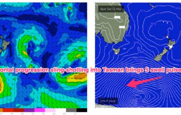
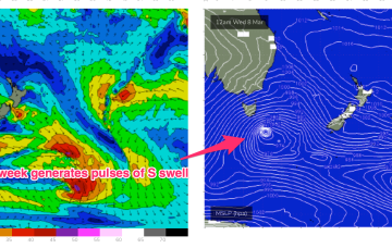
A deeper fetch slingshotting NE from the Southern Ocean brings a much stronger S swell pulse Mon.
/reports/forecaster-notes/eastern-tasmania/2023/03/08/offshore-winds-continue-the-weekend-pulse-s
freeride76
Wednesday, 8 March 2023
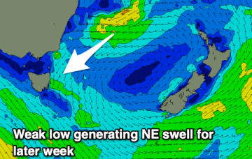
The high moves rapidly NE into the Tasman next week and that puts us back into NE windswell territory as winds increase off the South Coast and down to Bass Strait.
/reports/forecaster-notes/eastern-tasmania/2023/03/06/offshore-winds-all-week-small-s-swell-pulses-ne
freeride76
Monday, 6 March 2023
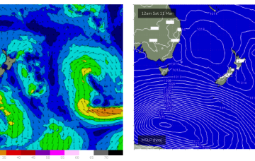
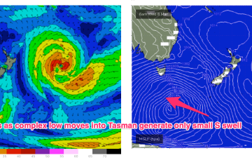
Unfortunately this strong cold outbreak now looks to stall just too far West (behind the swell shadow of Tasmania) to really deliver any strong S swell to the East Coast, before weakening as it moves into the Tasman Sea swell window proper. We will see small S swell pulses.
/reports/forecaster-notes/eastern-tasmania/2023/03/03/s-swell-turns-chunky-ne-windswell-weekend-then
freeride76
Friday, 3 March 2023
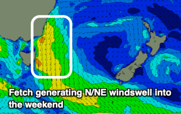
Through Sun we’ll see increasing NE-N winds, along with a vey well aimed fetch of NE winds off the Gippsland to Bass Strait stretch whipping up NE windswell.
/reports/forecaster-notes/eastern-tasmania/2023/03/01/workable-swells-around-the-compass-season
freeride76
Wednesday, 1 March 2023
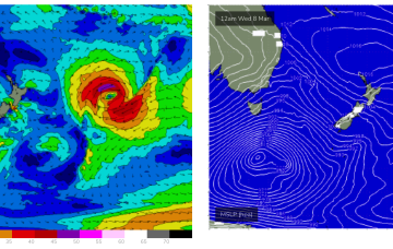
Further south a deep polar low and frontal system is generating large swells, with traces of long period S swell refracting back into Eastern Tas over the coming days. A weak, troughy pattern is NE of Tas now with a high pressure system expected to drift over the state through Fri.
/reports/forecaster-notes/eastern-tasmania/2023/02/27/rapid-fire-wind-changes-week-small-swell-pulses
freeride76
Monday, 27 February 2023
The troughy pattern will see rapid fire wind changes across Eastern Tasmania this week.
/reports/forecaster-notes/eastern-tasmania/2023/02/24/fun-ne-windswell-weekend-small-surf-next-week
freeride76
Friday, 24 February 2023
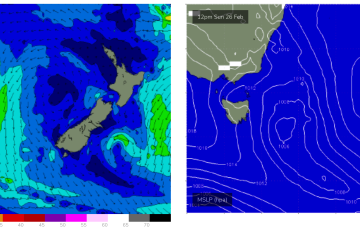
No great change to the weekend f/cast. High pressure is now drifting SE towards the South Island with an approaching trough tightening the pressure gradient and leading to fresh N’ly winds for Eastern Tasmania .
/reports/forecaster-notes/eastern-tasmania/2023/02/22/nice-looking-nne-windswell-expected-build-over
freeride76
Wednesday, 22 February 2023
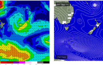
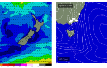
Monday looks even juicier. An approaching trough of low pressure tightens pressure gradients and the fetch really winds up in the swell window.
/reports/forecaster-notes/eastern-tasmania/2023/02/20/poor-week-more-options-the-weekend
Craig
Monday, 20 February 2023
Dicey winds and weak windswells this week, a bit stronger on the weekend.