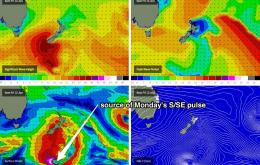
South facing beaches in Sydney saw plenty of 3-4ft sets in the last hour or so before dark this evening, so this is a reasonable guide as to what we can expect across south facing beaches in Northern NSW on Thursday as this southerly swell continues its way up the East Coast.
Primary tabs
As detailed throughout much of last week we’ve got three distinct pulses due this week, spaced roughly two days apart.
As alluded to in Wednesday’s notes, each of these swells will be spaced about two days apart, with smaller conditions between them.
We’ve got a mixed bag for the rest of the week, but I’m not confident we’ll see anything amazing.
A small south swell currently pushing up along the NSW coast will be the only source of new energy for the short term forecast period.
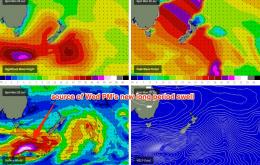
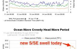
Surf wise, the fun small E/NE swell of the last few days will be almost completely gone but in its wake we’re looking at a building S/SE swell on Saturday from a low pressure system parked off New Zealand’s South Island on Thursday
Prior to this we’ll see a fun round of peaky surf for much of Thursday, but slowly easing E/NE thru’ NE swell across open beaches.
Winds are now already fresh E’ly at Cape Byron which suggests the morning session may not bear much fruit in some areas, even with a reasonably solid swell in the water (however winds are light/variable elsewhere).
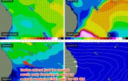
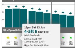
The swell models still have a very strong east swell progged for Saturday however as per Wednesday’s evaluation, I believe that it’s overcooking these heights, by combining two swell trains into one - a short range trade swell off the Coral Sea ridge, and a distant E’ly groundswell from a depression that formed NE of New Zealand earlier in the week.
No major change from our eastern swell window for Thursday. The small trade swell that’s occupied our region this week should maintain slow inconsistent sets between 2ft and occasionally 3ft at swell magnets in Far Northern NSW and SE Qld.

