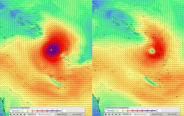
The models are suggesting a late season tropical low will form in the Coral Sea this weekend.
Primary tabs
Sunday just became a little more complex within the model guidance.
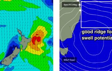
Ex-TC Donna is currently re-emerging from the swell shadow of New Caledonia, and will generate a fresh E’ly tending swell for all coasts.
STC Donna reached Cat 4 strength over the weekend, and was actually upgraded to Cat 5 this morning, with average wind speeds of 110kts and gusts to 140kts. That's about 260km/hr.
Crikey - the long term surf forecast got a heck of a lot more difficult over the last few days.
We’ve got a complex weekend of waves but ultimately it’s looking pretty fun for SE Qld.
This strengthening ridge looks very interesting for SE Qld surfers in the long term, thanks to a possible Tropical Cyclone that’s expected to form near Vanuatu around Thursday.
The south swell currently on display across the region dropped rapidly across Southern NSW early this morning and we can expect a similar trend across our region into Saturday.
And that’s essentially it from our eastern swell window for the time being. A series of fronts will dominate the entire forecast period, and thus we’re looking at an extended period of south swell for the state.
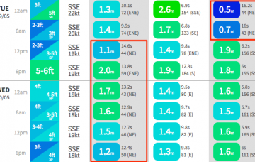
Dawn on Tuesday morning may possibly see a ‘low point’ in size between swells, but by mid morning we should see the leading edge of this new E’ly swell that is expected to reach a peak late in the day or overnight.

