Plenty of fun E'ly swell ahead
South-east Queensland and Northern NSW Surf Forecast by Ben Matson (issued Wednesday 10th May)
Best Days: Thurs/Fri: fun waves across outer points in SE Qld and Far Northern NSW under a S'ly breeze and a fun pulsey E'ly swell. Light winds on the Mid North Coast Friday so good beachies. Sat/Sun: fun beaches everywhere though getting a little small by Sunday.
Recap: Yesterday and today have both seen some great waves across SE Qld, originating from a couple of sources related to Severe Tropical Cyclone Donna. However, surf size came in below expectations - up to 4-5ft at some exposed beaches, and smaller south of the border. The reasoning for the smaller-than-anticipated size is very complex, and not properly understood due to a lack of quantifiable data about the status of STC Donna, as well as the fact that Cat 5 cyclones are rare events - indeed, as is any kind of major swell generating activity in our NE swell window (a couple of theories have been discussed in the comments in Monday's notes, here - specifically around the shadowing obstacles within our NE swell window). But regardless, there were some excellent waves at those points offering shelter from the southerly breeze, with most regions seeing lighter winds today and thus a broader spread of clean conditions. Also in the water over the last few days across Northern NSW was a building south swell from a Tasman Low. Winds have been mainly out of the south - and as a side note, the apparent temp at Byron Bay has hovered around ten degrees all day, owing to the low air temps and high moisture content.

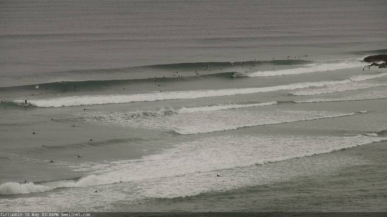
Currumbin looking the goods this afternoon, via our surfcam
This week (May 11 - 12)
Ex-TC Donna is currently re-emerging from the swell shadow of New Caledonia, and will generate a fresh E’ly tending swell for all coasts. However, this fetch is tracking unfavourably S/SE so northern locations (i.e. north of the border) will see a brief flush of energy, whilst more southern locations should see a slightly longer plateau in size.
Underneath this pulse will be an undercurrent of residual E’ly trade swell, generated by the supporting ridge to the south of ex-TC Donna, which has been in place for quite a few days now. This should maintain an inconsistent 3ft of E’ly swell at most beaches through Thursday ahead of the new pulse that’s expected in the afternoon and should persist into Friday morning. 3-4ft sets are likely during this period before it eases off into Friday afternoon.
Also in the mix over the coming days will be more S’ly swell from the Tasman Low, though it’s in a much weakened state compared to Monday where we saw an impressive band of gales hugging the Southern NSW coast (producing some 8-10ft surf at offshore bombies yesterday).
A reasonable fetch of southerly winds are currently wrapping around the low’s western flank, and they will generate a fresh pulse for Thursday across Northern NSW. This should increase surf size to around 3ft+ throughout the day before easing slowly during Friday.
Moderate to fresh S’ly winds will persist across all coasts on Thursday under the influence of a ridge through the Coral Sea and the Tasman Low just to the south-east of our region. Though, we should see some isolated regions of SW winds in the morning.
As the Tasman Low weakens and tracks east into Friday, light variable winds should envelop the Mid North NSW coast however persistent S/SE winds are expected north from about Evans Head (again, pockets of SW winds are possible). As such, the next few days will see the best surf across the outer points in Far Northern NSW and SE Qld regions.
This weekend (May 13 - 14)
Looks like a fun weekend with light variable winds both days and slowly easing swells from the east.
Friday afternoon’s easing trend should still maintain some early 3ft sets into Saturday morning, before it eases back to around 2-3ft during the day and further to 2ft into Sunday.
Northern NSW should see small levels of residual though easing S’ly swell on Saturday (early 2ft+ sets at south facing beaches), but there probably won’t be much left by Sunday.
All in all, it should be a great weekend for the beachbreaks - it’ll certainly be worth aiming for an isolated stretch of coast to get away from the crowded hubs, as in reality everywhere should be pretty much dish up the same kind of surf this weekend.
Next week (May 15 onwards)
I’ll be keeping my eye on some developments near the NW tip of New Zealand’s North Island on Friday, being a three-way merger between our weakening Tasman Low, ex-TC Donna and a broad trough through the Coral Sea which is modelled to track SE to this region. Model guidance suggest it’ll be mainly aimed up into New Cal and Fiji however it’d only take a slight tweak in the direction to result in a decent SE swell overnight Sunday or early Monday.
Otherwise, the models have eased the prospects of redeveloping trades and a possible coastal trough early next week. However there is a suggestion for a broad troughy pattern through the guts of the Tasman at some point next week. This could be early ingredients for a decent system to develop in this region mid-late next week (specifically, the northern Tasman) - but it’s still early days. More on this in Friday’s notes.


Comments
Is this the new E'ly pulse? Looks clean and strong at Currumbin.
Bit of push in the swell, sets inco but fun as.
Solid 3-4ft on the Tweed Coast this morning, early high tide is swallowing things up but it's reasonably chunky. Shame there's a bit of wind on it; bank situation still pretty funky too.