Dynamic outlook but mostly windy
Friday, 28 March 2025

Dynamic outlook but mostly windy
Friday, 28 March 2025
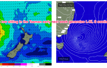
Make the most of today ahead of a poor, windy weekend, continuing early next week with some stronger SW groundswell in the mix.