/reports/forecaster-notes/south-east-queensland-northern-new-south-wales/2017/05/24/fun-swells-east
thermalben
Wednesday, 24 May 2017
Friday is much better all round as the new E’ly swell is expected to coincide with a relaxation of the coastal pressure gradient and thus light variable winds and sea breezes.
/reports/forecaster-notes/south-east-queensland-northern-new-south-wales/2017/05/22/strong-easing-se
thermalben
Monday, 22 May 2017
Southern NSW has retained plenty of size all day so we should be looking at some solid waves for the early session on Tuesday though a gradual easing trend is expected throughout the day.
/reports/forecaster-notes/south-east-queensland-northern-new-south-wales/2017/05/19/improving-surf
thermalben
Friday, 19 May 2017
Lots of swell for the next week ahead.
/reports/forecaster-notes/south-east-queensland-northern-new-south-wales/2017/05/17/tricky-surf
thermalben
Wednesday, 17 May 2017
We’re still looking at the same broad synoptic pattern but the particulars have changed; most notably the strength and consolidation (or lack thereof) of an E’ly fetch through the lower Coral Sea.
/reports/forecaster-notes/south-east-queensland-northern-new-south-wales/2017/05/15/fun-surf-beachies
thermalben
Monday, 15 May 2017
The models are suggesting a late season tropical low will form in the Coral Sea this weekend.
/reports/forecaster-notes/south-east-queensland-northern-new-south-wales/2017/05/12/another-burst-fun
thermalben
Friday, 12 May 2017
Sunday just became a little more complex within the model guidance.
/reports/forecaster-notes/south-east-queensland-northern-new-south-wales/2017/05/10/plenty-fun-ely
thermalben
Wednesday, 10 May 2017
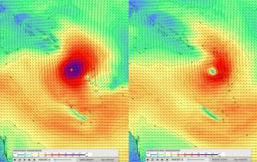
Ex-TC Donna is currently re-emerging from the swell shadow of New Caledonia, and will generate a fresh E’ly tending swell for all coasts.
/reports/forecaster-notes/south-east-queensland-northern-new-south-wales/2017/05/08/standby-ne
thermalben
Monday, 8 May 2017
STC Donna reached Cat 4 strength over the weekend, and was actually upgraded to Cat 5 this morning, with average wind speeds of 110kts and gusts to 140kts. That's about 260km/hr.
/reports/forecaster-notes/south-east-queensland-northern-new-south-wales/2017/05/05/small-weekend-o
thermalben
Friday, 5 May 2017
Crikey - the long term surf forecast got a heck of a lot more difficult over the last few days.
/reports/forecaster-notes/south-east-queensland-northern-new-south-wales/2017/05/03/fun-weekend-surf
thermalben
Wednesday, 3 May 2017
We’ve got a complex weekend of waves but ultimately it’s looking pretty fun for SE Qld.

