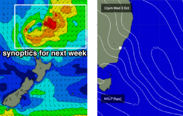
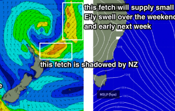
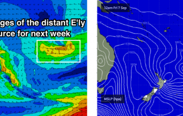
Looking further afield, and we’ve got some interesting developments elsewhere, with deepening tropical activity south of Fiji broadening a surface trough through the north-eastern Tasman Sea through the first half of the week, forming an impressive E/NE fetch that’ll probably stretch way out into the South Pacific.
Primary tabs
We’ve got a complex outlook ahead, with tropical cyclones, long period southerly swells, sub-tropical lows and local troughs contributing swells of varying strength and sizes. Bring it on, eh?
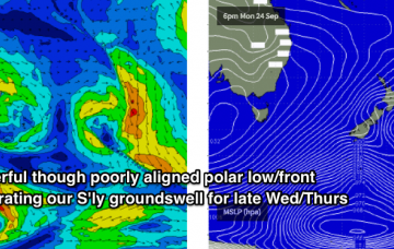
We’ve got a multitude of small swell source inbound (long range E’ly, short range S/SE) but the most dominant swell trains over the coming days will be a series of overlapping southerly swells generated by strong, though poorly aligned frontal activity through the Southern Tasman Sea.
So, with three distinct swell trains in the water - none of which are being picked up very well by the global wave models - I reckon you’ll do pretty well at most open beaches.
Over the weekend, we’ll see a slow, steady undercurrent of long range E’ly swell generated by a broad subtropical low NE of New Zealand.
This morning is the pick of the forecast period as we’ll see inconsistent though building S’ly swell and early light winds. More details in the Forecaster Notes.
There's a couple of swell sources on the way but local winds look tricky.
The models didn’t really pick up today's SE swell very well, but I think the guidance is pretty good for the next few days. And that is: nothing of any great interest.
This swell will reach a peak overnight and will trend down into Tuesday, and we’ll see the most size through Northern NSW.
There's a couple of swell sources for the forecast period but local winds look really tricky.

