/reports/forecaster-notes/south-east-queensland-northern-new-south-wales/2021/03/24/mediocre-autumn
James KC
Wednesday, 24 March 2021
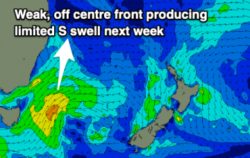
Fading swell with offshore winds before a few weak S changes bring limited swell.
/reports/forecaster-notes/south-east-queensland-northern-new-south-wales/2021/03/22/ne-surge-tomorrow
James KC
Monday, 22 March 2021
Stormy conditions will continue tomorrow before winds finally swing offshore on Wednesday
/reports/forecaster-notes/south-east-queensland-northern-new-south-wales/2021/03/19/e-swell-lingering
James KC
Friday, 19 March 2021
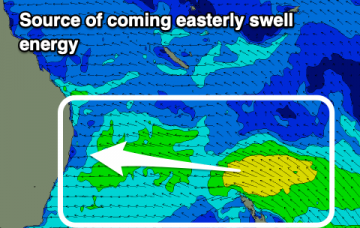
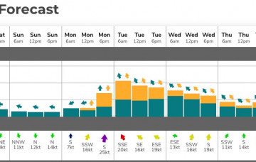
E swell will peak Sunday into Monday and then being a very slow downward trend lingring into the middle of next week.
/reports/forecaster-notes/south-east-queensland-northern-new-south-wales/2021/03/17/plenty-waves
James KC
Wednesday, 17 March 2021
Fading S swell ahead of a building E/SE swell followed by an E swell for the weekend.
/reports/forecaster-notes/south-east-queensland-northern-new-south-wales/2021/03/15/plenty-swell
James KC
Monday, 15 March 2021
A series of S, SE and E pulses but with winds out of the E/SE for most of the week there'll be limited options.
/reports/forecaster-notes/south-east-queensland-northern-new-south-wales/2021/03/12/flag-the-weekend
thermalben
Friday, 12 March 2021
The outlook for next week is very dynamic, but the short story is that there’s likely to be plenty of swell - and probably wind - on the way.
/reports/forecaster-notes/south-east-queensland-northern-new-south-wales/2021/03/10/nothing-note
James KC
Wednesday, 10 March 2021
Not much going on, a little bit of action for the Mid N Coast but looks better for next week.
/reports/forecaster-notes/south-east-queensland-northern-new-south-wales/2021/03/08/return-spring
James KC
Monday, 8 March 2021
Fading S swell and then not a lot going on. Spring conditions make a return for the second week of autumn.
/reports/forecaster-notes/south-east-queensland-northern-new-south-wales/2021/03/05/weekend-solid-s
James KC
Friday, 5 March 2021
A prolonged, active and elongated polar front is set to provide multiple S pulses, arriving overnight and keeping plenty of energy in the water until at least Tuesday.
/reports/forecaster-notes/south-east-queensland-northern-new-south-wales/2021/03/03/window-tomorrow
James KC
Wednesday, 3 March 2021
Decent waves tomorrow morning and then solid swell to last over the weekend and into the new week.

