/reports/forecaster-notes/south-east-queensland-northern-new-south-wales/2017/03/01/stacks-swell
thermalben
Wednesday, 1 March 2017
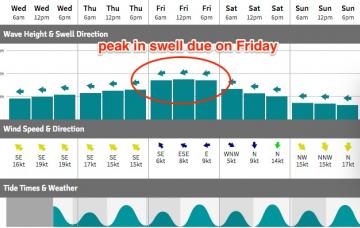
Model guidance still has a peak in size for tomorrow, which is plausible - however I think the models are a little skewed at the moment. They’ve undercalled the last few days, and tomorrow are combining two swell trains out of the east and north-east, which I think is slightly inflating prospective surf size, if only a smidge.
/reports/forecaster-notes/south-east-queensland-northern-new-south-wales/2017/02/27/fun-week-easterly
thermalben
Monday, 27 February 2017
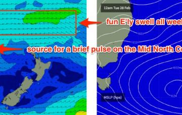
We’re looking at a gradual increase through Tuesday and Wednesday ahead of a peak in size on Thursday, before size trends down slowly into Friday.
/reports/forecaster-notes/south-east-queensland-northern-new-south-wales/2017/02/24/waves-waves-waves
thermalben
Friday, 24 February 2017
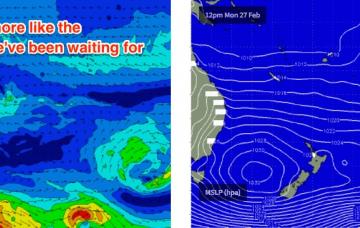
We’ve got some super fun waves on the way for next week.
/reports/forecaster-notes/south-east-queensland-northern-new-south-wales/2017/02/22/finally-stacks
thermalben
Wednesday, 22 February 2017
Looks like a whole week or more of fun trade swell ahead for the entire region.
/reports/forecaster-notes/south-east-queensland-northern-new-south-wales/2017/02/20/small-swells-mid
thermalben
Monday, 20 February 2017
Well, it’s nice to see a few days ahead without the capital “N” in the wind progs.
/reports/forecaster-notes/south-east-queensland-northern-new-south-wales/2017/02/17/poor-weekend
thermalben
Friday, 17 February 2017
Let’s cut to the chase - northerly winds (along with a lack of swell) will severely limit quality surf options across all coasts this weekend.
/reports/forecaster-notes/south-east-queensland-northern-new-south-wales/2017/02/15/patchy-surf
thermalben
Wednesday, 15 February 2017
A broad, multi-centered tropical low stretching from the northern Coral Sea through the South-western Pacific Ocean will remain slow moving for much of the forecast period.
/reports/forecaster-notes/south-east-queensland-northern-new-south-wales/2017/02/13/tricky-week-south
thermalben
Monday, 13 February 2017
The south swell that built across Southern NSW today should broaden its presence across Northern NSW on Tuesday.
/reports/forecaster-notes/south-east-queensland-northern-new-south-wales/2017/02/10/easing-ely-swells
thermalben
Friday, 10 February 2017
The primary source of today’s strong swell has largely eased throughout our swell window, and is pulling away to the east.
/reports/forecaster-notes/south-east-queensland-northern-new-south-wales/2017/02/08/building-ely
thermalben
Wednesday, 8 February 2017
There’s plenty of swell ahead for the coming days.

