No great change to the outlook as a tradewind fetch anchored by tropical low pressure near New Caledonia remains active before the low slides off to the SE later tomorrow and into Fri. We’ll see continuing tradeswells from this source.
Primary tabs
/reports/forecaster-notes/sydney-hunter-illawarra/2025/02/05/fun-waves-the-tropics-continue-easing
freeride76
Wednesday, 5 February 2025

/reports/forecaster-notes/sydney-hunter-illawarra/2025/02/02/nothing-major-the-tropics-small-blends
freeride76
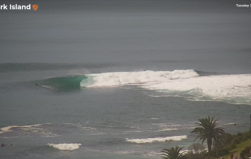
Monday, 3 February 2025
High pressure support for the tropical systems which is currently anchoring a tradewind fetch in the Coral Sea weakens substantially over the short term, with E swell potential thus weakening. We’ll still see some fun E’ly trade swell in the sub-tropics, trickling down into temperate regions.

/reports/forecaster-notes/sydney-hunter-illawarra/2025/01/31/minor-mixed-bag-the-weekend-the-tropics
freeride76
Friday, 31 January 2025
Weak high pressure moves into the Tasman with the remnants of a trough holding a modest fetch of SE breezes in the central Tasman.
/reports/forecaster-notes/sydney-hunter-illawarra/2025/01/29/small-offerings-the-short-term-radar-the
freeride76
Wednesday, 29 January 2025
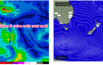
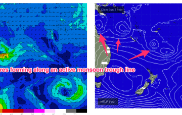
The tropics is in an active state with multiple low centres expected along the monsoon trough as it responds to a phase of the MJO passing into Australian longitudes. Still plenty of uncertainty there, with any meaningful swell a while away.

/reports/forecaster-notes/sydney-hunter-illawarra/2025/01/26/small-mixed-bag-swells-week-and-next
freeride76
Monday, 27 January 2025
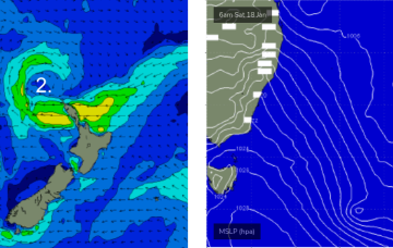
Longer term is starting to look more dynamic as the tropics finally starts to fire up. Multiple low pressure systems are suggested on long range model guidance, potentially tropical cyclones.
/reports/forecaster-notes/sydney-hunter-illawarra/2025/01/24/patchy-surf-the-foreseeable-future
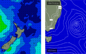
thermalben
Friday, 24 January 2025
Today’s strengthening southerly winds are related to a developing Tasman Low that is poorly aligned within our swell window, and tracking unfavourably to the east.
/reports/forecaster-notes/sydney-hunter-illawarra/2025/01/22/mix-swell-sources-flukey-winds-top
thermalben
Wednesday, 22 January 2025
As suggested in Wednesday’s notes, I’m not keen on the alignment of this Tasman Low.
/reports/forecaster-notes/sydney-hunter-illawarra/2025/01/20/punchy-east-swell-the-next-few-days-then
thermalben
Monday, 20 January 2025
A final low pressure system associated with our recent complex synoptic pattern moved from a position north of New Zealand last week, into the Tasman Sea over the weekend.

/reports/forecaster-notes/sydney-hunter-illawarra/2025/01/17/flag-the-weekend-early-next-week-looking
thermalben
Friday, 17 January 2025
The Tasman Sea currently has a number of low pressure centers, driving strong winds from a couple of directions across various parts of the basin.

/reports/forecaster-notes/sydney-hunter-illawarra/2025/01/15/stacks-swell-and-wind-the-short-term
thermalben
Wednesday, 15 January 2025
A few changes to the outlook for the weekend, but in general I’m still anticipating better surf early next week.