/reports/forecaster-notes/south-east-queensland-northern-new-south-wales/2015/01/16/long-term-outlook
thermalben
Friday, 16 January 2015
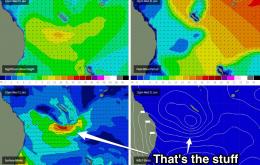
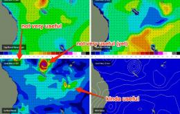
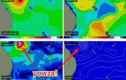
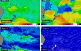
The long term focus is is in the Coral Sea where we’re expecting some significant developments throughout the week as a broad Tropical Low develops north-west of New Caledonia and tracks southwards.
/reports/forecaster-notes/south-east-queensland-northern-new-south-wales/2015/01/14/period-small-surf
thermalben
Wednesday, 14 January 2015
In actual fact there are two south swells on the way, but the first won’t really make much of an impact north of Seal Rocks.
/reports/forecaster-notes/south-east-queensland-northern-new-south-wales/2015/01/09/can-synoptic
thermalben
Friday, 9 January 2015
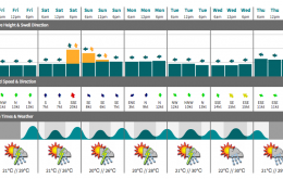
The weekend forecast is pretty straight forward - slowly down on Saturday and slowly up on Sunday.
/reports/forecaster-notes/south-east-queensland-northern-new-south-wales/2015/01/07/exciting-period
thermalben
Wednesday, 7 January 2015
The rest of the week should see a fairly event trend in the surf department.
/reports/forecaster-notes/south-east-queensland-northern-new-south-wales/2015/01/05/extended-run
thermalben
Monday, 5 January 2015
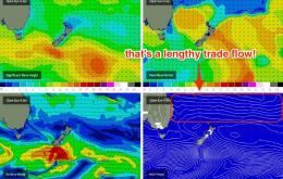
The broad persistent trade flow across our entire east swell window will continue to generate fun surf for the coast.
/reports/forecaster-notes/south-east-queensland-northern-new-south-wales/2015/01/02/excellent-outlook
thermalben
Friday, 2 January 2015
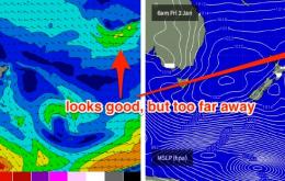
We’ve got strengthening trades in the lower Coral Sea right now, and they’re building easterly swells that’ll provide plenty of surf through the weekend.
/reports/forecaster-notes/south-east-queensland-northern-new-south-wales/2014/12/31/slowly-building
thermalben
Wednesday, 31 December 2014
More of the same intermittent east swell for the rest of the week, plus a new south swell for exposed south facing beaches in Northern NSW.
/reports/forecaster-notes/south-east-queensland-northern-new-south-wales/2014/12/29/workable-short
thermalben
Monday, 29 December 2014
The long range trade swell will continue to pulse intermittently across most beaches for much of the week.
/reports/forecaster-notes/south-east-queensland-northern-new-south-wales/2014/12/26/uninspiring
thermalben
Friday, 26 December 2014
The computer models have been shifting around the position of the weekend’s North Coast ridge, so the corresponding forecast now has a little less confidence than a few days ago.
/reports/forecaster-notes/south-east-queensland-northern-new-south-wales/2014/12/24/fun-waves-exposed
thermalben
Wednesday, 24 December 2014
Christmas Day looks OK for an average afternoon session.

