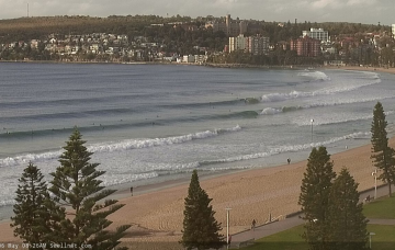
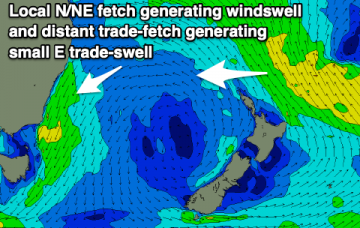
The wind outlook for the next fourteen days says it all: light and variable. All the result of a blocking high in the Tasman Sea.
Primary tabs
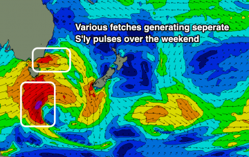
/reports/forecaster-notes/sydney-hunter-illawarra/2019/05/17/doldrums-small-southerly-swell-regime
thermalben
Friday, 17 May 2019
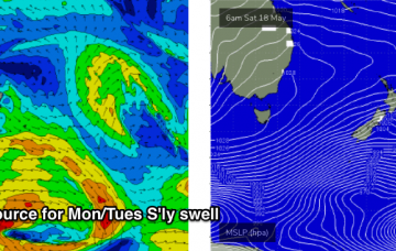
/reports/forecaster-notes/sydney-hunter-illawarra/2019/05/15/southerly-regularity
thermalben
Wednesday, 15 May 2019
The rest of the week will continue to see favourably light winds and weak sea breezes under a weak synoptic pattern. As for surf, the current southerly regime will persist for some time. More in the Forecaster Notes.
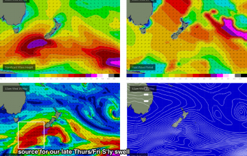
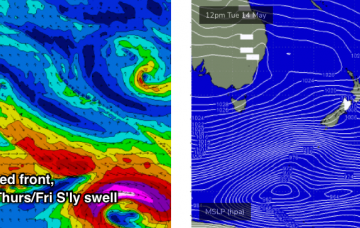
/reports/forecaster-notes/sydney-hunter-illawarra/2019/05/13/plenty-south-swell-way-good-winds-boot
thermalben
Monday, 13 May 2019
First glance of the swell graphs suggests tiny surf and light winds all week. However, we’ve got some really nice waves on the way. More in the Forecaster Notes.
/reports/forecaster-notes/sydney-hunter-illawarra/2019/05/10/saturday-size-most-next-week-conditions
thermalben
Friday, 10 May 2019
Saturday morning will see a large Tasman Low intensify well off the Southern NSW coast. More in the Forecaster Notes.
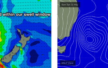
/reports/forecaster-notes/sydney-hunter-illawarra/2019/05/08/coupla-unusual-swell-sources-watch
thermalben
Wednesday, 8 May 2019
Unfortunately, the latest model runs have narrowed the width of the responsible fetch - a post-frontal W/SW flow exiting eastern Bass Strait - and also tweaked its direction a little more zonally, away from our swell window. More in the Forecaster Notes.

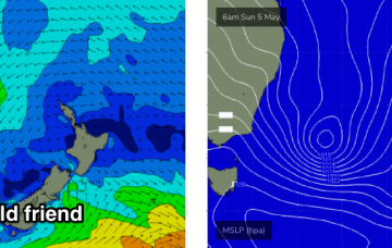
/reports/forecaster-notes/sydney-hunter-illawarra/2019/05/06/wide-range-great-waves-across-coming
thermalben
Monday, 6 May 2019
The Tasman Low responsible for our current swell is reaching maturity to the east of Bass Strait, and peak swell energy will push across the coast overnight into Tuesday.
/reports/forecaster-notes/sydney-hunter-illawarra/2019/05/03/downgrade-weekend-there-are-still-great
thermalben
Friday, 3 May 2019
There’s been a bit of argy bargy in the models, with a significant downgrade overnight Thursday, but a slight correction this afternoon. More in the Forecaster Notes.
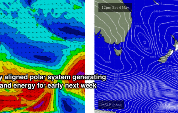
/reports/forecaster-notes/sydney-hunter-illawarra/2019/05/01/average-short-term-period-then-big-pulse
thermalben
Wednesday, 1 May 2019
We’ve got plenty of swell due next week. More in the Forecaster Notes.
/reports/forecaster-notes/sydney-hunter-illawarra/2019/04/29/best-make-most-easing-south-swell
Craig
Monday, 29 April 2019
Easing S'ly swell tomorrow with decent conditions, slow thereafter until next week.
/reports/forecaster-notes/sydney-hunter-illawarra/2019/04/26/plenty-south-swell-tomorrow-cleanest
Craig
Friday, 26 April 2019
Multiple S'ly swell pulses over the weekend that are a little tricky to pin down with workable winds. One standout day for the weekend, with interesting developments later next week.