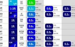
The trend for the next few days is down.
Primary tabs
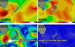
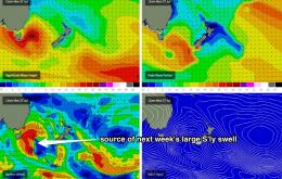
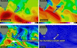
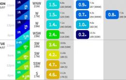
All of this activity will contribute strong southerly swell to the region on Tuesday.
If the swell models are to be believed, we’re looking at a small drop in swell height and a small increase in swell period into Saturday.
Only small surf is expected for the rest of the week, of which south facing beaches - for the first time in quite a while - will end up seeing the smaller end of the size spectrum. This will mainly affect locations like Cronulla, Bondi and the Northern Hunter.
After a couple of weeks of dynamic activity, we’ve got a somewhat benign outlook period ahead.
We’ve got a complex mix of south swells both arriving and departing, but in any case Saturday’s conditions will be heavily affected by gusty trailing southerly winds in the wake of the low, as it tracks eastward.
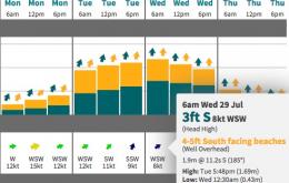
Today’s southerly swell is expected continue trending slowly downwards into Thursday morning, however a new pulse of south swell is expected to arrive during the day.
The building trend we’re seeing now will probably reach a peak overnight and then ease throughout Tuesday.
We’ve got a very complex period ahead, and to be honest I’m still not especially confident on the surf outlook for early next week.
The current south swell should continue through Thursday, and local winds are looking to be light and variable again under the influence of a high pressure system slowly tracking eastward through the southern Tasman Sea.

