Small surf for the short term; complex outlook from Wednesday onwards
Sydney, Hunter and Illawarra Surf Forecast by Ben Matson (issued Friday 26th May)
Best Days: Sat/Sun should have small clean waves from the E/NE, though very inconsistent. Mon should see a small S'ly swell at south swell magnets. There's also sizeable potential for the middle to latter part of next week too.
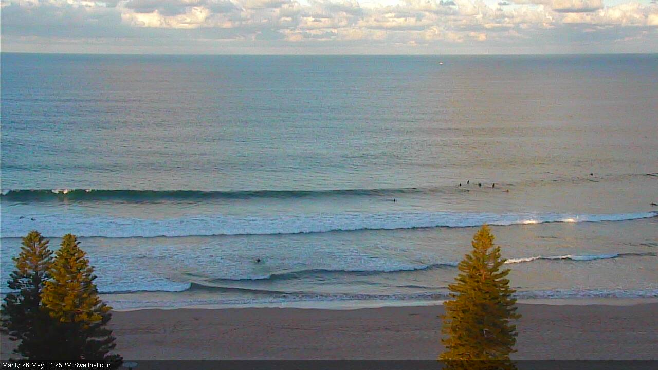
Recap: Thursday delivered a fun round of S’ly swell with mainly light winds. Today the south swell has eased but a small new E/NE swell has built across the coast, though it’s coming in at the bottom end of forecast expectations (2ft against a forecast of 2-3ft), and the sets are very infrequent. Conditions are however nice and clean with light offshore winds.

Small lines at Manly this afternoon
This weekend (Sat 27th - Sun 28th)
I'm expecting only small surf this weekend, though conditions should be clean with mainly light winds.
With today’s E/NE swell coming in a little under budget, I’m pulling back my expectations for the weekend’s waves to be more around 2ft+ (compared to Wednesday's estimate of 2-3ft). It’s only a minor difference but with the distant swell source - and a retreating fetch at that - it’s hard to see much more size than what we’ve got on offer right now.
Set waves will also be very inconsistent. A fresh pulse within the swell train is expected on Sunday morning which may increase the consistency for a period of time, but in general there will be extremely long breaks between sets.
Conditions look pretty good overall, with light winds Saturday morning picking up from the north into the afternoon (so aim for a morning paddle). On Sunday winds will tend NW then fresh W’ly later as a front pushes across the region.
Next week (Mon 29th onwards)
A front exiting eastern Bass Strait on Sunday will generate a flukey, directional south swell for Monday. It’ll mainly bypass the Southern NSW coast but a handful of reliable south swell magnets - most of them in the Hunter region - could pick up occasional 2ft to perhaps 2-3ft sets.
Elsewhere, expect easing, very inconsistent and very small leftover E/NE swell from the South Pacific.
Small, residual energy will prevail through Tuesday and possibly early Wednesday ahead of a gusty southerly change that could spawn a mid-week Tasman Low. The models are quite divergent on this scenario so we’ll need a few more days to iron things out but at this stage it’s looking like a windy, sizeable middle to latter part of next week for some parts of the East Coast.
The big question at the moment is whether our mid-week system will be placed in the central/southern Tasman Sea (favouring southern NSW) or central/northern Tasman Sea (favouring Northern NSW), the latter of which would also be outside of our swell window. It’s simply too early too have any confidence in either scenario. I'll update in the notes over the weekend as more information comes to hand.
Have a great weekend, see you Monday!

