Flat until later next week
Eastern Tasmanian Surf Forecast by Craig Brokensha (issued Friday June 24th)
Best Days: No good days until late next week
Features of the Forecast (tl;dr)
- Mod-large S'ly swell likely Fri PM with strong S/SW-SW winds, easing Sat with W/SW winds
Recap
Small levels of infrequent E/NE swell yesterday mixed in with some local windswell, clean but tiny and fading today.
This weekend and next week (Jun 25 – Jul 1)
Unfortunately the current outlook lacks any swell of any kind as a series of mid-latitude fronts push across us from the west. They'll be too zonal in nature to generate any refracted S'ly swell but this looks to change into late next week/weekend.
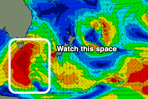
We've got a strong cold outbreak forecast for us, with a strong polar low due to form to our south-west on Wednesday, projecting slowly north-east through Thursday evening and Friday.
 This will see a significant fetch of S/SW gales projected north through our swell window, generating a large S'ly groundswell mixed in with mid-period energy next Friday/Saturday.
At this stage we're looking at surf to the 6ft range Friday afternoon on the south magnets but with strong S/SW-SW winds, easing Saturday from a similar size and with better W/SW offshore winds.
Check back here on Monday for more on this though. Have a great weekend!

