Tiny to flat until early next week
Eastern Tasmania Forecast by Craig Brokensha (issued Wednesday 22nd July)
Best Days: Tuesday next week
Recap
Tiny yesterday, while an expected pulse of N/NE windswell today was seen to 2ft+ this morning, with a further pulse expected this afternoon as winds tended more offshore.
This week and weekend (Jul 23 – 26)
Today's windswell is due to be gone by tomorrow with a W'ly change overnight.
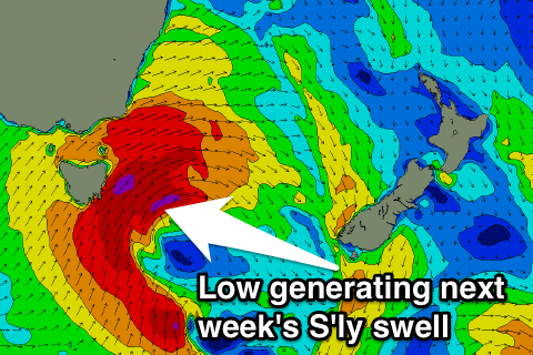
There's nothing significant at all on the cards until next week, when a vigorous cold front moves in from the west.
 This system is due to move in Monday, projecting a fetch of gale to severe-gale S/SW winds up through our southern swell window.
The morning is likely to be tiny, with an afternoon pulse in size to 4-5ft across south swell magnets, peaking Tuesday morning in the 5-6ft range at this stage.
Winds will be less than ideal Monday and from the S/SW-SW, but Tuesday should see more favourable W/SW breezes favouring open beaches.
After this pulse of S'ly swell, there's nothing major on the cards again, so check back here Friday for an update on the timing, size and local winds for early next week.

