/reports/forecaster-notes/south-east-queensland-northern-new-south-wales/2016/03/16/small-peaky
thermalben
Wednesday, 16 March 2016
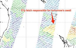
Our primary, near source of trade swell began to weaken yesterday so from here we’re looking at a slow easing trend into Thursday.
/reports/forecaster-notes/south-east-queensland-northern-new-south-wales/2016/03/14/plenty-small-surf
thermalben
Monday, 14 March 2016
We’re now on the backside of the current trade swell event, but the good news is that there’s plenty of fun surf to come.
/reports/forecaster-notes/south-east-queensland-northern-new-south-wales/2016/03/11/lotsa-trade-swell
thermalben
Friday, 11 March 2016
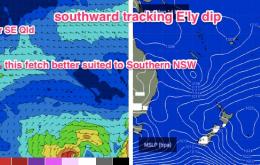
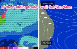
The synoptics show a strengthening E’ly dip SW of New Caledonia, embedded in the broader trade flow, and plenty of swell generating winds extending further east into the South Pacific
/reports/forecaster-notes/south-east-queensland-northern-new-south-wales/2016/03/09/average-trade
thermalben
Wednesday, 9 March 2016
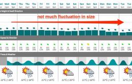
The broader trend of a slow upwards increase from Saturday through Monday is still on track.
/reports/forecaster-notes/south-east-queensland-northern-new-south-wales/2016/03/07/generally-small
thermalben
Monday, 7 March 2016
In summary: there’s nothing major on the cards for the foreseeable future. But, there will be waves most days with a moderate summer trade pattern expected to remain steady across our eastern swell window
/reports/forecaster-notes/south-east-queensland-northern-new-south-wales/2016/03/04/small-ely-swell
thermalben
Friday, 4 March 2016
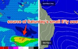
However, large swells are not a crucial ingredient for good surf in this neck of the woods - the key to scoring decent waves is to look for small bumps in swell energy, that coincide with periods of favourable winds
/reports/forecaster-notes/south-east-queensland-northern-new-south-wales/2016/03/02/continuation
thermalben
Wednesday, 2 March 2016
These’ll be the shortest forecast notes in weeks, I tells ya.
/reports/forecaster-notes/south-east-queensland-northern-new-south-wales/2016/02/29/extended-run
thermalben
Monday, 29 February 2016
No major swells expected this week, and local winds will be variable tending onshore, so surface conditions won’t be terribly good.
/reports/forecaster-notes/south-east-queensland-northern-new-south-wales/2016/02/26/large-ely-swell
thermalben
Friday, 26 February 2016
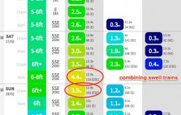
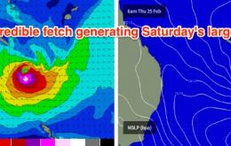
We’re still on track for a very large E’ly pulse.
/reports/forecaster-notes/south-east-queensland-northern-new-south-wales/2016/02/24/large-large-large
thermalben
Wednesday, 24 February 2016
This will certainly be one of the biggest easterly groundswells in many years.

