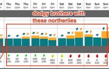
An advancing trough from the south-west later this week will freshen NE winds Thursday and Friday, ahead of a weekend of gusty northerlies.
Primary tabs
/reports/forecaster-notes/south-east-queensland-northern-new-south-wales/2017/11/27/make-most-tueswed
thermalben
Monday, 27 November 2017
/reports/forecaster-notes/south-east-queensland-northern-new-south-wales/2017/11/24/endless-trade
thermalben
Friday, 24 November 2017
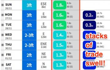
An anchored synoptic pattern will maintain plenty of trade swell across all coasts through next week and into the following weekend.
/reports/forecaster-notes/south-east-queensland-northern-new-south-wales/2017/11/22/fun-new-ely-swell
thermalben
Wednesday, 22 November 2017
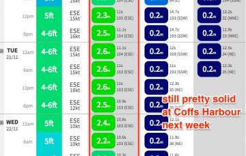
So, we’re now well and truly on the backside of our fun E’ly swell, and residual energy will pad out most of Thursday and Friday.
/reports/forecaster-notes/south-east-queensland-northern-new-south-wales/2017/11/20/easing-surf-tues
thermalben
Monday, 20 November 2017
So, we look like we’re close to the top of the initial swell cycle from our lovely little weather system that developed north of New Zealand last week.
/reports/forecaster-notes/south-east-queensland-northern-new-south-wales/2017/11/17/solid-ese-swell
thermalben
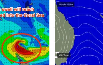
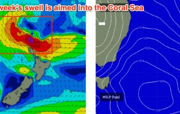
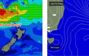
Friday, 17 November 2017
So, I’ve been tracking the much-discussed incoming E/NE swell for two weeks now (first mentioned in these Forecaster Notes on Nov 3rd), and since then the system has upgraded and downgraded itself many times.
/reports/forecaster-notes/south-east-queensland-northern-new-south-wales/2017/11/15/plenty-strong
thermalben
Wednesday, 15 November 2017
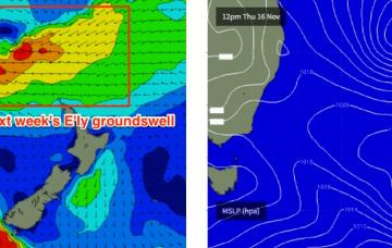
So yeah - we’ve still got a decent E/SE groundswell on the way for early next week.
/reports/forecaster-notes/south-east-queensland-northern-new-south-wales/2017/11/13/small-conditions
thermalben
Monday, 13 November 2017
The upshot at this point in time is that the weekend will kick off with a small trade swell.
/reports/forecaster-notes/south-east-queensland-northern-new-south-wales/2017/11/10/fun-weekend-waves
thermalben
Friday, 10 November 2017
This system will be a major source of swell for us over the weekend and into the first half of the following week.
/reports/forecaster-notes/south-east-queensland-northern-new-south-wales/2017/11/08/average-mix-swell
thermalben
Wednesday, 8 November 2017
The Coral Sea ridge will weaken slightly into the weekend and contract to the north, which will in turn weaken wind speeds across the coast.
/reports/forecaster-notes/south-east-queensland-northern-new-south-wales/2017/11/06/plenty-south
thermalben
Monday, 6 November 2017
Before we get stuck into surf size estimates, we also need to look at the other dominant factor for the entire week - persistent SE winds.