/reports/forecaster-notes/sydney-hunter-illawarra/2019/01/21/fun-waves-most-days-eclectic-bunch-swell
thermalben
Monday, 21 January 2019
The Tasman Sea won’t see a great deal of synoptic activity throughout the forecast period, so most of our swell sources will originate from more distant, flukey swell windows.
/reports/forecaster-notes/sydney-hunter-illawarra/2019/01/18/small-patchy-period-waves-ahead
thermalben
Friday, 18 January 2019
We’ve got one final push of short range NE windswell.
/reports/forecaster-notes/sydney-hunter-illawarra/2019/01/16/peaky-ne-swell-persist-few-more-days
thermalben
Wednesday, 16 January 2019
Rinse and repeat for the next few days.
/reports/forecaster-notes/sydney-hunter-illawarra/2019/01/14/extended-run-ne-windswell-ahead-sly
thermalben
Monday, 14 January 2019
A slow moving Tasman high will deliver a fairly steady run of NE wind and NE windswell this week.
/reports/forecaster-notes/sydney-hunter-illawarra/2019/01/11/multiple-small-swell-sources-inbound
thermalben
Friday, 11 January 2019
A stationary trade flow through the northern Tasman Sea/Lower Coral Sea and South Pacific will become slightly enhanced with an easterly dip forming south of Fiji over the weekend. More in the Forecaster Notes.
/reports/forecaster-notes/sydney-hunter-illawarra/2019/01/09/triad-small-peaky-swells-finish-week
thermalben
Wednesday, 9 January 2019
The combination of these swells should produce occasional fun peaks at exposed beaches. More in the Forecaster Notes.
/reports/forecaster-notes/sydney-hunter-illawarra/2019/01/07/lots-interesting-swells-ahead-funky
thermalben
Monday, 7 January 2019
A deep Southern Ocean low has generated a long period S’ly groundswell that’s just pushing into Tasmanian coasts as we speak.
/reports/forecaster-notes/sydney-hunter-illawarra/2019/01/04/wide-range-fun-surf-ahead-lots
thermalben
Friday, 4 January 2019
In fact there is a suggestion we could see a small closed low form off the Hunter coast on Sunday.
/reports/forecaster-notes/sydney-hunter-illawarra/2019/01/02/plenty-fun-swells-out-north-east
thermalben
Wednesday, 2 January 2019
Tropical Cyclone Penny is redeveloping in the Coral Sea though will remain outside of our swell window. As such it’s not seen as a swell source for Southern NSW.
/reports/forecaster-notes/sydney-hunter-illawarra/2018/12/31/sustained-pattern-light-winds-and-small
thermalben
Monday, 31 December 2018
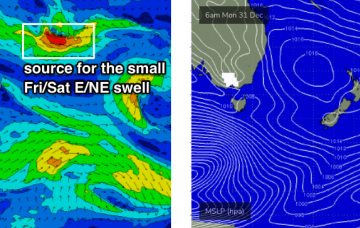
A near stationary synoptic pattern will deliver only subtle changes in surf conditions this week.


