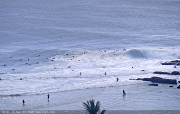
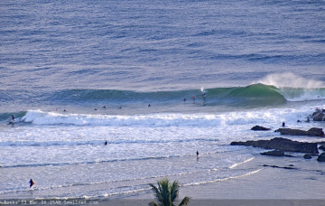
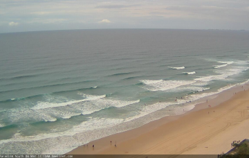
Gusty S/SE winds will persist through Tuesday and Wednesday throughout SE Qld and Far Northern NSW, maintaining great waves at various points where the sand is stacking up properly. More in the Forecaster Notes.
Primary tabs
/reports/forecaster-notes/south-east-queensland-northern-new-south-wales/2020/03/16/another-dynamic
thermalben
Monday, 16 March 2020
/reports/forecaster-notes/south-east-queensland-northern-new-south-wales/2020/03/13/more-wind-more
thermalben
Friday, 13 March 2020
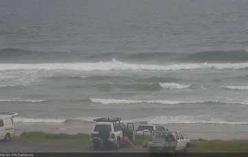
Synoptically speaking, Saturday will mark a somewhat low point between this week’s windy conditions, and a fresh run of S/SE gales throughout the region. More in the Forecaster Notes.
/reports/forecaster-notes/south-east-queensland-northern-new-south-wales/2020/03/11/lots-more-wind
thermalben
Wednesday, 11 March 2020
Looks like a whole week of continuing windy weather ahead for SE Qld and Far Northern NSW. And potentially some large swell in the mix too. More in the Forecaster Notes.
/reports/forecaster-notes/south-east-queensland-northern-new-south-wales/2020/03/09/wind-wind-wind
thermalben
Monday, 9 March 2020
A strong ridge will remain anchored across southern Queensland for the next few days, maintaining fresh to strong S/SE thru’ SE winds throughout SE Qld and Far Northern NSW. More in the Forecaster Notes.
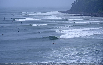
/reports/forecaster-notes/south-east-queensland-northern-new-south-wales/2020/03/06/extended-run
thermalben
Friday, 6 March 2020
Another forecast period with a stack of swells on the way. Dig in! More in the Forecaster Notes.
/reports/forecaster-notes/south-east-queensland-northern-new-south-wales/2020/03/04/overdue-return
thermalben
Wednesday, 4 March 2020
We’ve got a brief window of opportunity this weekend, for a small section of the coastline. More in the Forecaster Notes.
/reports/forecaster-notes/south-east-queensland-northern-new-south-wales/2020/03/02/few-windows-good
thermalben
Monday, 2 March 2020
Today’s S’ly groundswell will reach a peak in size overnight and - based on trend observations across Victoria and Southern NSW - will likely ease steadily through Tuesday morning. But, there's more swell on the way! More in the Forecaster Notes.
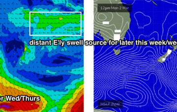
/reports/forecaster-notes/south-east-queensland-northern-new-south-wales/2020/02/28/patchy-short-term
thermalben
Friday, 28 February 2020
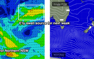
Next week will see a continual background source of E’ly swell from a stationary fetch in the South Pacific, atop a large high pressure system, slowly building towards a next weekend. Prior to then we'll see a bunch of S'ly groundswells for Northern NSW. More in the Forecaster Notes.
/reports/forecaster-notes/south-east-queensland-northern-new-south-wales/2020/02/26/residual-andor
thermalben
Wednesday, 26 February 2020
The weekend outlook has changed a lot since Monday. But the long term is very promising. More in the Forecaster Notes.
/reports/forecaster-notes/south-east-queensland-northern-new-south-wales/2020/02/24/wide-range-swell
thermalben
Monday, 24 February 2020
A more dominant swell will provide decent waves for south facing beaches south of Byron both Tuesday and Wednesday. Next week looks very interesting too! More in the Forecaster Notes.