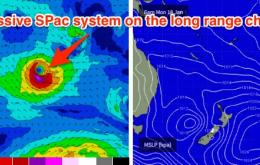
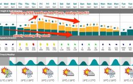
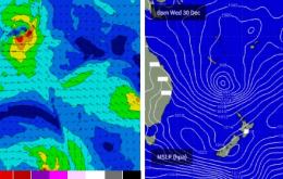
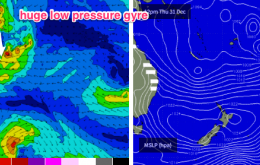
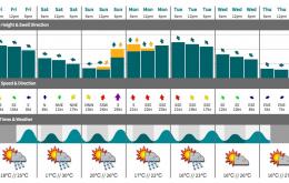
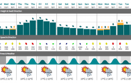
Thursday is also expected to see a new, building long period S/SE swell all day, generated by an intense polar low that formed off the ice shelf over the weekend. But, the erratic swell source (possibly contaminated by Antartican ice floes) and enormous travel distance guarantees a couple of things: very inconsistent set waves, and low confidence for any notable surf.
Primary tabs
We have two new groundswells on the way, which should provide good waves at some selected locations mid-week.
A pretty easy description for the weekend - steadily easing all day Saturday, then up strongly on Sunday from the south, but only favouring Northern NSW, specifically south facing beaches.
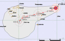
There’s also been some interesting developments with TC Ula.
Truth be told: I don’t think we’re going to see quite as good surf from STC Ula as previous expected.
The current S/SE swell will ease through this afternoon, overnight and into Saturday. But as we’ve been anticipating all week we have a new E’ly swell due to arrive overnight that’ll provide great waves across the weekend.
We have a renewal of S/SE energy pushing up the coast today thanks to a small low that developed within the trough line extending the length of the Tasman Sea, on Tuesday.
A reinforcing pulse from the S/SE is expected later Wednesday and into Thursday, originating from a new low forming along the trough line in the SE Tasman Sea today.
The fetch across the central/northern Tasman Sea will rotate slightly anti-clockwise today, veering more E/NE, which will shut down the swell supply for Far Northern NSW and SE Qld but still maintain plenty of surf across the Mid North Coast into Saturday.
We’ve got some fun waves in store for the rest of the week.

