Lots of swell next week; followed by a slow period
Nias, Mentawai, South Sumatra forecast by Craig Brokensha (issued Tue 6th May)
Best Days: Every day over the coming period
This week and next week (May 8 - 15th)
Since Tuesday's update there's been no real change to the weekend's forecast S/SW swell or the much larger and more powerful S/SW groundswell due later Monday ahead of a peak Tuesday.
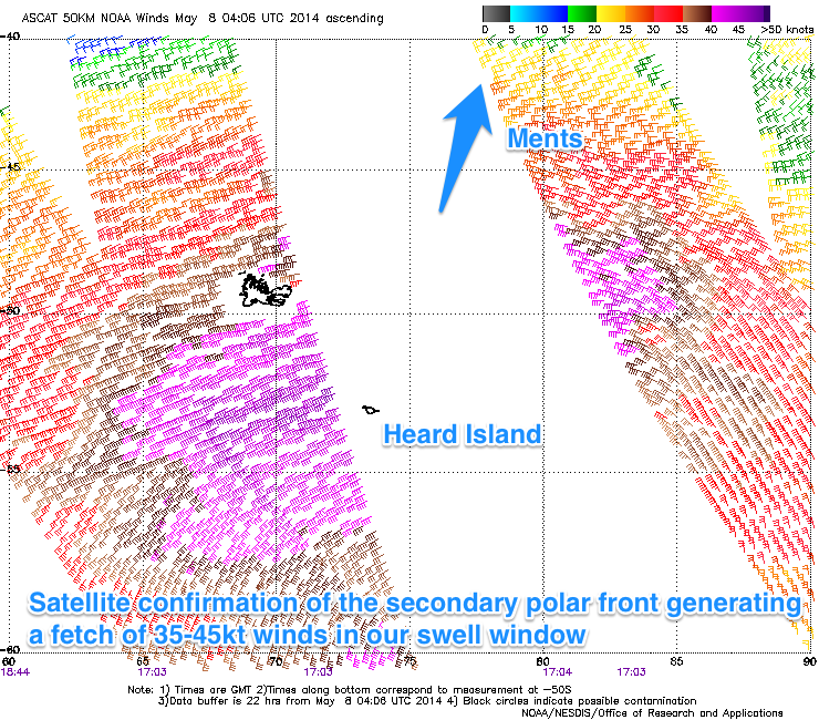
 Satellite observations have confirmed the model forecast winds of 35-50kt winds in the Southern Indian Ocean from a couple of vigorous polar fronts piggybacking each other (pictured right).
This has generated two strong pulses of S/SW groundswell, the first arriving Monday and building to the 6ft+ range later in the day ahead of a much larger pulse Tuesday to 8ft+ in the Ments with 10ft sets at swell magnets and larger 8-01ft+ surf in South Sumatra. Nias should see inconsistent 6-8ft surf at the peak of the swell Tuesday.
Winds should continue to remain light and variable for the most part and if not light from the N'th Tuesday favouring spots picking up the most size.
A drop in swell is due on Wednesday but the surf will still be large and not for in-experienced surfers.
A secondary large but not to the size of Tuesday's swell is due on Friday morning, generated by another vigorous polar front pushing up further into the Southern Indian Ocean than the systems before it, but with not as much strength or width.
Still, this should see exposed spots pulsing back to 6-8ft in the Ments with slightly more size in Southern Sumatra, while Nias will be smaller again but still solid.
From Friday afternoon onwards though wave heights will back off and probably bottom out on Tuesday.
Longer term we may see a new medium sized SW groundswell mid next week, but we'll have to review this next week. In the meantime make the most of the coming swells!

