Slow with potential next week
Eastern Tasmania Surf Forecast by Craig Brokensha (issued Wednesday 28th April)
Best Days: Sunday for the desperate
Features of the Forecast (tl;dr)
- Small N/NE windswell Sun with W/NW-N/NW winds
- Large stormy swell out of the E developing next week but with onshore winds
Recap
Fading surf yesterday, lingering into today, but only minimal.
This week and next (Apr 29 - May 7)
There’s nothing too major on the cards for the coming week with the surf remaining unsurfable through until Sunday, when a small N/NE windswell looks to build.
 Size wise the swell generating fetch looks weaker and recedes away from us Sunday, and only a small 2ft wave is likely across the north-east magnets along with W/NW-N/NW winds. All other breaks will be tiny.
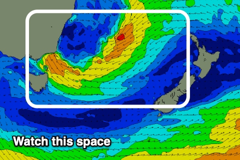
Longer term we’ve got much juicer developments on the cards as a surface trough moving in from the west early next week forms into a broad, multi-centred low, stretching across Victoria and New South Wales.
A strong ridge of high pressure to our south will see strong to gale-force E/SE-E/NE winds projected into us, kicking up an initial stormy swell that will get larger and stronger later in the week. We won’t see winds improve until the low clears to the east though and this might not occur until the weekend. Therefore check back here Friday and next week for a clearer idea for what’s in store.

