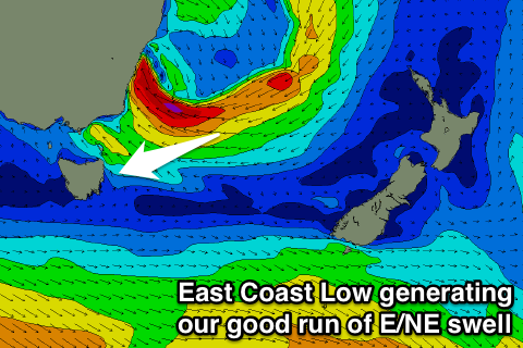
Excellent waves over the coming three days
Eastern Tasmania Forecast by Craig Brokensha (issued Monday 18th July)
Best Days: Tuesday, Wednesday morning, Thursday morning
This week (Aug 19 - 22)
 A deep and complex low deepening off the Southern NSW Coast has now taken the form of an East Coast Low, with a fetch of severe-gale E/NE to E'ly winds wrapping around its southern flank being aimed through our swell window.
This has generated a strong pulse of E/NE groundswell that should of shown on dark today and is expected to peak through tomorrow to 4-5ft+ across open beaches.
A slight drop in size is due into the afternoon, but we should continue to see plenty of size into Wednesday and Thursday morning as the low starts to weaken and broaden tomorrow while continuing to aim a fetch of strong E/NE winds towards us.
Open beaches should still be in the 3-4ft range Wednesday before easing from 2-3ft Thursday morning.
Winds should swing offshore during tomorrow morning, creating clean conditions ahead of a weak S'ly change into the late afternoon. Wednesday will be great again with offshore W/SW winds and weak SE breezes later while Thursday will again see W'ly tending NE winds.
Into the end of the week there's nothing too major on the cards and unfavourable N'ly winds.
This weekend onwards (Aug 23 onwards)
There's nothing too major on the cards for the weekend and beyond besides smaller levels of NE windswell. Therefore make the most of the coming week of waves and favourable conditions each morning.

