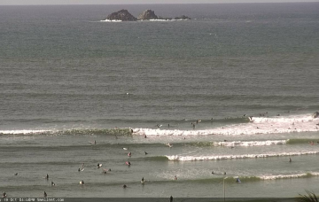
A broad infeed of E/NE winds feeding into the Tasman trough and a stationary trade flow south of Fiji will supply small E’ly swells for our region all week.
Primary tabs
/reports/forecaster-notes/south-east-queensland-northern-new-south-wales/2018/10/22/small-swells-all
thermalben
Monday, 22 October 2018

/reports/forecaster-notes/south-east-queensland-northern-new-south-wales/2018/10/19/make-most
thermalben
Friday, 19 October 2018
We’ve got plenty of waves ahead for the weekend, but northerly winds are really going to cause some problems. More in the Forecaster Notes.
/reports/forecaster-notes/south-east-queensland-northern-new-south-wales/2018/10/17/stacks-ely-swell
thermalben
Wednesday, 17 October 2018
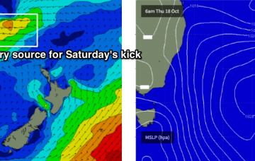
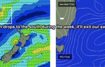
For the next few days, we can divide the forecast into two distinct parts: swell and wind.
/reports/forecaster-notes/south-east-queensland-northern-new-south-wales/2018/10/15/large-swells-poor
thermalben
Monday, 15 October 2018
In any case, large swells will persist into Tuesday (too big for most coasts) so you’l be better off leaving things until we see an easing in the size department and an abatement of wind speeds later this week throughout SE Qld.
/reports/forecaster-notes/south-east-queensland-northern-new-south-wales/2018/10/12/large-surf-and
thermalben
Friday, 12 October 2018
We’ve got a complex synoptic chart more reminiscent of February than October. But hey! I’ll take it anyway. Check the Forecaster Notes for more details.
/reports/forecaster-notes/south-east-queensland-northern-new-south-wales/2018/10/10/no-shortage-surf
thermalben
Wednesday, 10 October 2018
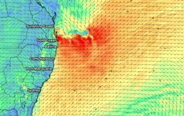
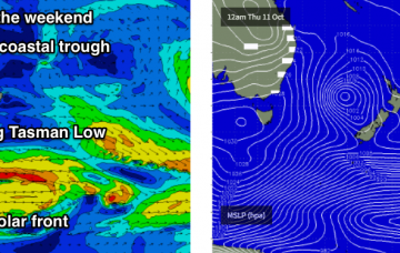
So, the swell charts may look active - but with perhaps three or four surfable options between the Byron and Sunshine Coasts, there’s not a great deal to look forward to for most weekend warriors. More in the Forecaster Notes.

/reports/forecaster-notes/south-east-queensland-northern-new-south-wales/2018/10/08/great-run-surf
thermalben
Monday, 8 October 2018
The model guidance shifted things around considerably over the weekend. However, this is actually a bonus for our region as the low’s likely new position will be very well positioned for Northern NSW, and thanks to its slow moving nature, will also be very beneficial for SE Qld.
/reports/forecaster-notes/south-east-queensland-northern-new-south-wales/2018/10/05/great-weekend
thermalben
Friday, 5 October 2018
Looks like a fun weekend of waves in many regions.
/reports/forecaster-notes/south-east-queensland-northern-new-south-wales/2018/10/03/stacks-swell
thermalben
Wednesday, 3 October 2018
Jeez, it’s a tricky weekend to forecast for. The Forecaster Notes have a wide range of swell and winds to discuss.

/reports/forecaster-notes/south-east-queensland-northern-new-south-wales/2018/10/01/peaky-trade-swell
thermalben
Monday, 1 October 2018
It seems as if there’s a thousand inbound swell sources throughout the forecast period, and that my head may explode. But, let’s get on and into it.
