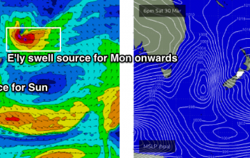
Our eastern swell window will remain the focus for the short, medium and long term outlook, and the forecast is generally very positive - plenty of swell, with just occasional bouts of dicey winds. More in the Forecaster Notes.
Primary tabs
/reports/forecaster-notes/south-east-queensland-northern-new-south-wales/2019/04/03/persistent-ely
thermalben
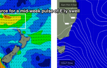
Wednesday, 3 April 2019
/reports/forecaster-notes/south-east-queensland-northern-new-south-wales/2019/04/01/mix-easterly
thermalben
Monday, 1 April 2019
So, we’ve actually got a couple of additional southerly swells still yet to arrive. But for most regions, this won’t be the dominant swell train in the water. More in the Forecaster Notes.

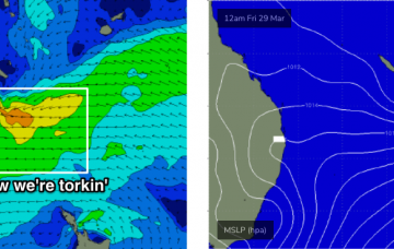
/reports/forecaster-notes/south-east-queensland-northern-new-south-wales/2019/03/29/tricky-short-term
thermalben
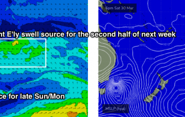
Friday, 29 March 2019
Small swells and northerly winds will create problems on Saturday. And we have a strong, short lived S'ly swell on the way plus a stack of E'ly swell. More in the Forecaster Notes.
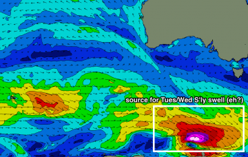
/reports/forecaster-notes/south-east-queensland-northern-new-south-wales/2019/03/27/lotsa-swell-many
thermalben
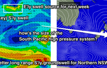
Wednesday, 27 March 2019
The source of today’s E/SE swell in the north sits between a trough in the southern Coral Sea, and a Tasman high pressure system. More in the Forecaster Notes.
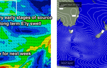
/reports/forecaster-notes/south-east-queensland-northern-new-south-wales/2019/03/25/patchy-week-waves
thermalben
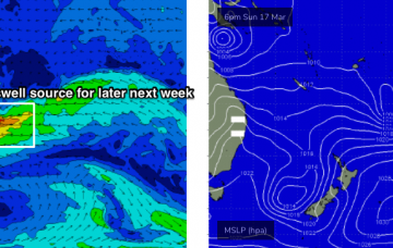
Monday, 25 March 2019
We've got a very good period of waves ahead beginning next week. More in the Forecaster Notes.
/reports/forecaster-notes/south-east-queensland-northern-new-south-wales/2019/03/22/patchy-surf-short
thermalben
Friday, 22 March 2019
The extended period looks very good for most regions. More in the Forecaster Notes.
/reports/forecaster-notes/south-east-queensland-northern-new-south-wales/2019/03/20/small-surf
thermalben
Wednesday, 20 March 2019
There’s plenty of surf in store for the longer term period. More in the Forecaster Notes.
/reports/forecaster-notes/south-east-queensland-northern-new-south-wales/2019/03/18/extended-run
thermalben
Monday, 18 March 2019
This week’s synoptic pattern is essentially a regional block, whereby there’s very little movement in the local weather systems from day to day and therefore no major change in local winds and weather either.
/reports/forecaster-notes/south-east-queensland-northern-new-south-wales/2019/03/15/ongoing-small
thermalben
Friday, 15 March 2019
As a side note, if you are in the water and you hear thunder, don’t hang around - lightning can travel tens of kilometres from the source region and the water is a pretty dangerous place to be at these times.
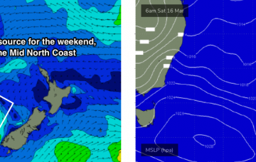
/reports/forecaster-notes/south-east-queensland-northern-new-south-wales/2019/03/13/small-surf
thermalben
Wednesday, 13 March 2019
On Friday, a tropical system is expected to begin slowly deepening south from Tonga, before driving south through our distant east swell window. More in the Forecaster Notes.