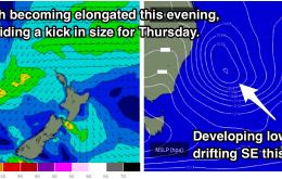
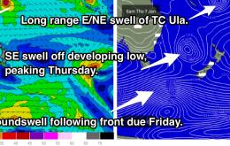
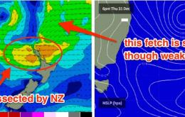
Multiple swell sources continuing to provide plenty of swell to end the week with Friday morning offering the best conditions.
Primary tabs
No shortage of swell generators in the coming week, however winds will be the limiting factor. Large SE swell initially, mixed in with long range E/NE mid week. Finally, S'ly groundswell late in the week.
A new E’ly swell is expected to fill into the region throughout Saturday. There may be a slight lag at dawn (read: small leftover surf) but otherwise we should see an upwards trend all morning ahead of a peak in the afternoon.
Looks like a very active weekend ahead of all East Coast surfers. In fact the next week and half should produce an extended period of excellent waves for many locations.
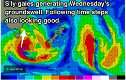
This system won’t be perfectly aligned for our region, but as its fetch will be working on an already active sea state, it will take less effort to kick up a decent groundswell - of which we’ll see some sideband energy glancing the coast throughout Wednesday, probably from lunchtime onwards.
Plenty of swell on the forecast, however local winds may cause an issue over the coming days. Initially, open beaches look to be bumpy for the best part of the day with options in the 2-3ft range rolling in. Then, the south facing beaches become the focus, with the potential for wind affected options in the 3-4ft range on Sunday.
Easterly swell on the menu for the end of the week, peaking on Staurday morning. A southerly change is then due, providing a strong kick in southerly windswell, followed by a sustained southeasterly swell in the 4ft range. We are hoping for light/variable-southelry breezes from Tuesday, but the outlook remains somewhat uncertain.
Plenty of swell for the open beaches late in the week, however persistent onshore winds are looking to cause a few problems. Morning sessions will offer the lightest winds and cleanest conditions, but nothing epic. Surf building into the weekend and early next week.
Pulses of swell coming at us from all angles. A northeasterly swell is looking to build on Saturday and Peak on Sunday across open beaches, cleanest each morning under light northerly breezes. A solid southerly swell is then expected to build into Wednesday, with the potential to exceed 4ft at south facing beaches.
A northeast windswell is due to build throughout the rest of this week, peaking on Sunday in the 3ft+ range. However, winds are looking dicey, so hit it early for the best conditions. A southerly change is due to provide the exposed beaches with a bit of size on Monday, limited by winds. Tuesday and Wednesday should then see the most significant south swell, possibly 3-5ft.

