/reports/forecaster-notes/sydney-hunter-illawarra/2015/08/14/small-weekend-solid-south-swell-tues
thermalben
Friday, 14 August 2015
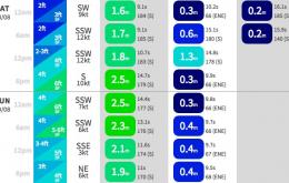
The current south swell will ease a little during Saturday, but we’ll see a minor reinforcement into Sunday afternoon from a small new south swell trailing a front that’ll push into the Tasman Sea tomorrow.
/reports/forecaster-notes/sydney-hunter-illawarra/2015/08/12/multitudes-south-swell
thermalben
Wednesday, 12 August 2015
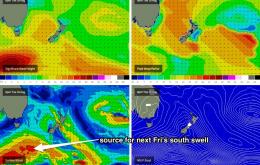
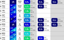
We’ve got plenty of interesting swell sources lining up for the next few days.
/reports/forecaster-notes/sydney-hunter-illawarra/2015/08/10/period-small-surf-ahead-next-swell-due
thermalben
Monday, 10 August 2015
So, right now we’re on the backside of the weekend’s south swell.
/reports/forecaster-notes/sydney-hunter-illawarra/2015/08/07/strong-weekend-south-swell-easing-next
thermalben
Friday, 7 August 2015
The last round of southerly swell from this pattern is starting to nose through the Southern Tasman Sea and we’re looking at some great waves for the weekend.
/reports/forecaster-notes/sydney-hunter-illawarra/2015/08/05/plenty-southerly-swell-ahead-southern
thermalben
Wednesday, 5 August 2015
We’ve got an extended period of active south swell inbound for Southern NSW.
/reports/forecaster-notes/sydney-hunter-illawarra/2015/08/03/lots-southerly-swell-inbound
thermalben
Monday, 3 August 2015
A deep low south of Tasmania - responsible for snow down to sea level there this morning - is tracking up into the Southern Tasman Sea, and generating a new swell for Southern NSW.
/reports/forecaster-notes/sydney-hunter-illawarra/2015/07/31/small-weekend-then-wide-range-sly-swell
thermalben
Friday, 31 July 2015
Don’t expect much surf this weekend - if you have to get wet, aim for an early paddle on Saturday.
/reports/forecaster-notes/sydney-hunter-illawarra/2015/07/29/small-period-then-renewal-solid
thermalben
Wednesday, 29 July 2015
The trend for the next few days is down.
/reports/forecaster-notes/sydney-hunter-illawarra/2015/07/27/solid-sly-swell-tuesday-easing-wednesday
thermalben
Monday, 27 July 2015
All of this activity will contribute strong southerly swell to the region on Tuesday.
/reports/forecaster-notes/sydney-hunter-illawarra/2015/07/24/tiny-weekend-strong-south-swell-next
thermalben
Friday, 24 July 2015
If the swell models are to be believed, we’re looking at a small drop in swell height and a small increase in swell period into Saturday.

