/reports/forecaster-notes/sydney-hunter-illawarra/2021/04/21/groundswell-the-weekend-otherwise-little
James KC
Wednesday, 21 April 2021
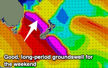
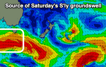
Smaller conditions for the remainder of the week before a groundswell arrives for the weekend.
/reports/forecaster-notes/sydney-hunter-illawarra/2021/04/19/smaller-waves-mid-week-another-series-s
James KC
Monday, 19 April 2021
Slower period of waves but coming back to life later in the week.
/reports/forecaster-notes/sydney-hunter-illawarra/2021/04/16/better-winds-and-more-s-swells
James KC
Friday, 16 April 2021
A nice period of S swells coming up, into the weekend and to start the new week.
/reports/forecaster-notes/sydney-hunter-illawarra/2021/04/14/bumpier-weekend-waves
James KC
Wednesday, 14 April 2021
S swells continue with bumpier conditions for the weekend.
/reports/forecaster-notes/sydney-hunter-illawarra/2021/04/12/offshore-winds-and-plenty-s-swell
James KC
Monday, 12 April 2021
There are a couple S/SE swells set to fill in throughout the week and with offshore winds there'll be an abundance of clean waves.
/reports/forecaster-notes/sydney-hunter-illawarra/2021/04/09/series-s-swells-next-week
James KC
Friday, 9 April 2021
Last of the E/NE swell will fade out over the weekend while a series of S swells begin to fill in.
/reports/forecaster-notes/sydney-hunter-illawarra/2021/04/07/abundance-swell-plenty-windows
James KC
Wednesday, 7 April 2021
E/NE swell to peak at the end of the week before a series of S swells occur over the weekend and into the start of the new week.
/reports/forecaster-notes/sydney-hunter-illawarra/2021/04/05/low-downgraded-followed-s-swell
James KC
Monday, 5 April 2021
E/NE swell to peak around Friday before S swell fills in for the weekend.
/reports/forecaster-notes/sydney-hunter-illawarra/2021/04/02/easter-calm-next-weeks-low
James KC
Friday, 2 April 2021
Small, clean surf for the Easter long weekend. Bumpier, messier conditions next week.
/reports/forecaster-notes/sydney-hunter-illawarra/2021/03/31/small-easter-waves-interesting-next-week
James KC
Wednesday, 31 March 2021
Easing SE swell into the weekend, range of swells for next week.

